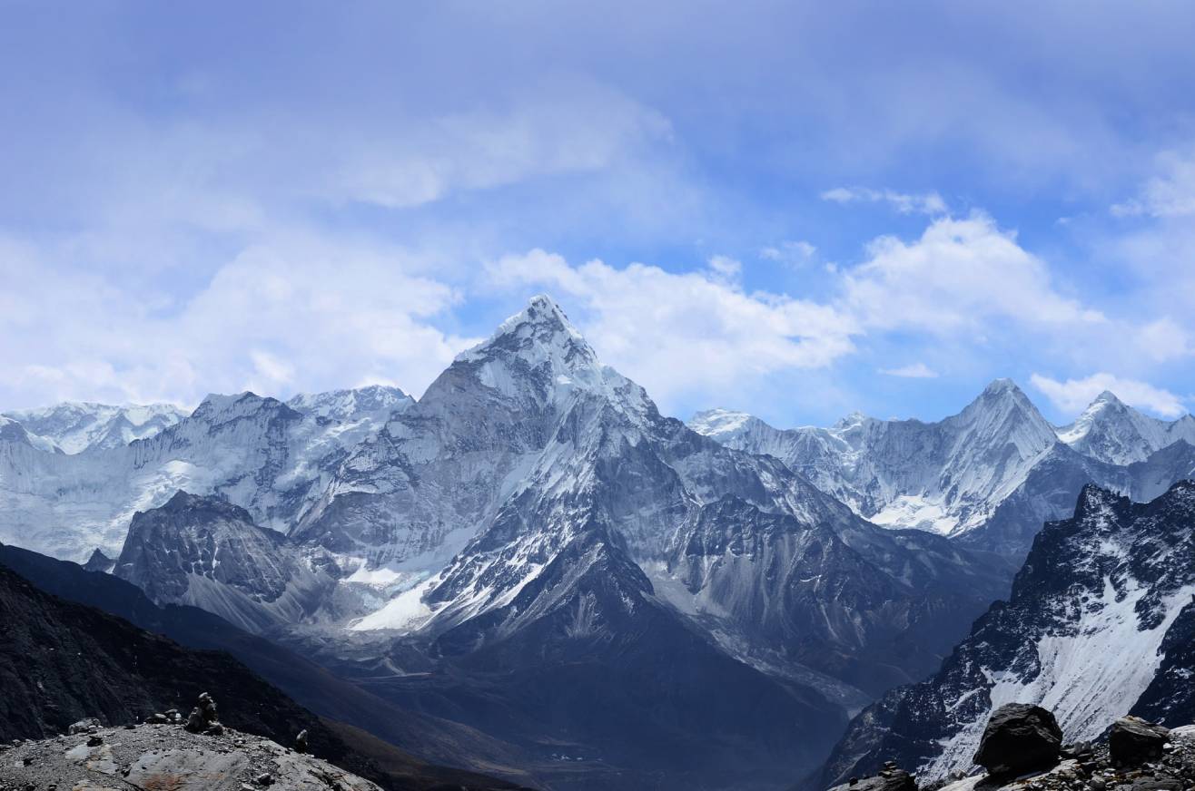
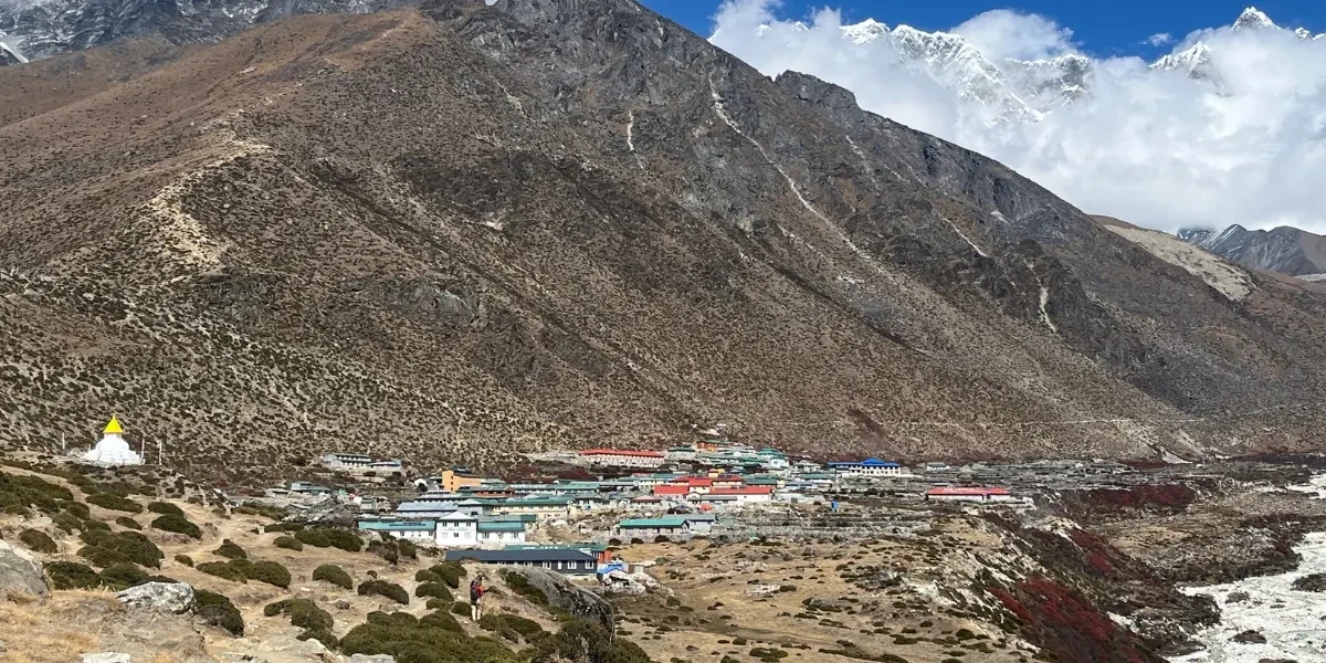
Dingboche is a quiet village located in the high-altitude Khumbu Region of Nepal, and is an important acclimatization stop on the way to Everest Base Camp (EBC) or in any major Himalayan trek. As if resting isn't enough for trekkers, Dingboche's location surrounded by the peaks of Ama Dablam, Lhotse, and Island Peak means that trekkers who stop here are treated to pristine Himalayan scenery that truly encompasses what the Himalayas are about.
If you are trekking in the Everest region, it is important that you understand Dingboche’s elevation, the weather and also some useful trekking advice. In this blog, we will cover everything you need to know in order to maximize your experience in Dingboche—EBC trek, Island Peak climbing or just enjoying a high mountain atmosphere.
Where is Dingboche?
Dingboche is located in the Solukhumbu District in northeastern Nepal and falls within Sagarmatha National Park, a UNESCO World Heritage Site. It is located in the Imja Valley and is surrounded by impressive peaks of:
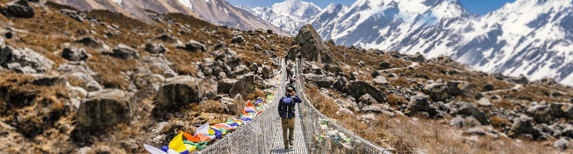
Dingboche is usually reached on a typical EBC trek on Day 4 or 5 usually stopping at the typical places of Phakding, Namche Bazaar and Tengboche.
Altitude of Dingboche
One of the significant factors related to Dingboche is actually the altitude of the village. Dingboche is built at a whopping 4,410 meters (14,468 feet) above sea level. A breathtaking setting at high altitude, but also difficult to breathe!
Why the Altitude is Important:
- Acclimatization Point: Most schedules for trekking to Everest Base Camp include two nights in Dingboche, in order to acclimatize to the air's thinner quality. Longer stays at Dingboche will decrease the possibility of experiencing Acute Mountain Sickness (AMS).
- Gateway to High Peaks: Dingboche is the jumping off point for Island Peak ascents, and it is also precariously close to the trail that heads towards Chhukung and Kongma La Pass.
What You Should Watch For:
At high altitude, some common symptoms of AMS could include:
- Headache
- Nausea or vomiting
- Dizziness
- Shortness of breath, especially with exertion
- Difficulty sleeping
Tip: Never ascend to a higher altitude when experiencing severe symptoms. Take the acclimatization seriously.
Weather in Dingboche
Because of its elevation and location in the Himalaya, Dingboche has extreme weather changes with considerable differences between seasons.
Spring (March–May)
- Temperature: Daytime: 0°C to 8°C | Night: -10°C to -15°C
- Weather: Clear skies, blooming rhododendron, good views.
- Best for: Trekking, photography.
Summer/Monsoon (June–August)
- Temperature: Daytime: 5°C to 12°C | Night: 0°C to -5°C
- Weather: Rain at lower elevations; Dingboche is drier but cloudier.
- Best for: Less crowded trails but with slick conditions.
Autumn (September–November)
- Temperature: Daytime: 0°C to 10°C | Night: -10°C to -15°C
- Weather: Crisp air, stable weather conditions, good visibility.
- Best for: Peak trekking season. Cool and dry conditions.
Winter (December–February)
- Temperature: Daytime: -5°C to 5°C | Night: -15°C to -25°C
- Weather: Very cold, likelihood of snow, few trekkers.
- Best for: Adventurers equipped for the cold, winter conditions.
NOTE: Due to the thin air, UV rays from the sun are extreme, use sunblock and UV protected sunglasses.
What to Expect in Dingboche
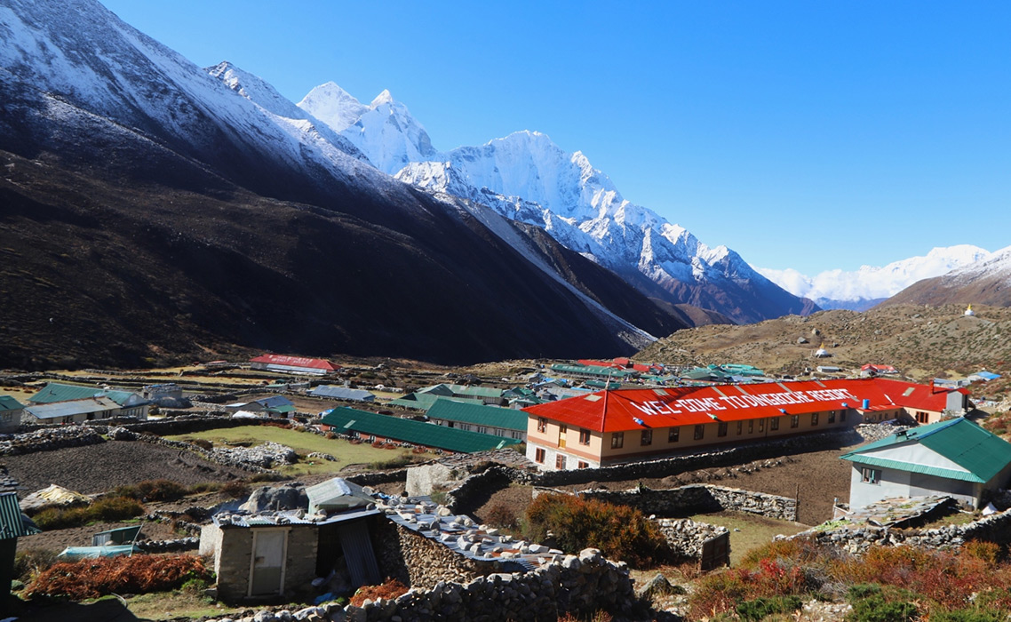
Although there is remoteness to Dingboche, it is reasonably well positioned for trekkers. This village has developed to suit the thousands of visitors that pass through it every season.
Facilities & Services:
- Teahouses & Lodges: where a comfortable bed, dining room and shared toilets are available.
- Wi-Fi and Charging: available for a fee. The connection can be limited and unreliable.
- Shops: small stores offering snacks, toiletries and limited trekking equipment.
- Medical: Has a seasonal aid post with the Himalayan Rescue Association, in nearby Pheriche (about 1 hour hiking).
Acclimatization Hikes:
Trekkers often add an extra day in Dingboche to acclimatize. Some of the most popular hikes:
- Nangkartshang Hill (should be shown on map, as 5,083 m): adequate views of Makalu and Lhotse and Ama Dablam.
- Chhukung Village: a half-day hike along the Imja Khola River that can add additional acclimatization as well as explore somewhere new.
Trekking tips for Dingboche and beyond:
1. Hydrate
Drink at least 3–4 liters of water every day. When you become dehydrated you increase your chances of developing AMS. You should try being prepared with purification tablets or a UV sterilizer.
2. Don't rush
Your climb from Tengboche to Dingboche is steep with considerable elevation gain and it is physically demanding. Go slow, stop often, listen to your body.
3. Gear Up for the Cold
Nighttime temperatures are significantly cooler than temperature in day. So bring:
- A sleeping bag rated to -10°C to -20°C
- Thermal base layers
- A down jacket
- Good gloves and wool hat
4. Eat High-Calorie Foods
At high altitudes your body burns calories more quickly. Eating at local teahouses each day prepares your body better than eating 1-2 big dinners in town. Meals often contain energy-rich foods such as:
- Dal Bhat (lentils, rice, vegetables)
- Pasta
- Sherpa stew
- Tibetan bread with honey or peanut butter
5. Don't Be Surprised by Limited Resources
Electricity is usually from solar. Charging your devices off cinema electricity or Wi-Fi will cost extra. So consider bringing:
- Power banks
- Solar charger (optional)
- Offline maps
Cultural and Scenic Highlights
Dingboche is not that large, but it's unlike other locations and offers a unique view of Sherpa culture. The bright colored prayer flags blowing in the cold wind, stone walls sorting the farmland and chortens (Buddhist shrines) indicating sacred places you pass by.
Spiritual worth:
The Imja Valley, the valley we are in, is sacred ground. Many of the local customs, as well as the region's primary religion, Buddhism, put significance on location. You will see many prayer wheels along the trail, as well as a few main stones (stones/rock with various engravings of Buddhist prayers).
Scenic worth:
Dingboche provides some of the most jaw-dropping scenery of the whole trip. You can see the below locations (from left to right) when the skies are clear:
- Lhotse (8,516 m) - 4th highest mountain in the world
- Island Peak (6,189 m) - very popular trekking peak
- Ama Dablam (6,812 m) - often called the "Matterhorn of the Himalayas"
Getting to Dingboche
Standard itinerary from Lukla:
- Lukla (2,860 m) - Flight from Kathmandu (the starting point).
- Phakding (2,610 m)
- Namche Bazaar (3,440 m) - Acclimatization stop.
- Tengboche (3,860 m) - Renowned for the monastery.
- Dingboche (4,410 m)
In total, it generally takes 5-6 days to get to Dingboche from Lukla depending on pace and acclimatization strategy.
Why Choose Nature Trail for Dingboche & Everest Region?
There are various trekking companies in Nepal, however, Nature Trail has some distinct characteristics in distinguishing them from other trekking agencies when exploring Dingboche & the Everest Region.
1. Professional & Certified Guides
Nature Trail has experienced, government licensed & medically-trained trekking guides with years of trekking at high elevation. Their understanding of the local terrain, culture, and protocols in emergency situations will provide a lot safer and knowledge based trekking experience.
2. Custom Itinerary
Whether trekking to Everest Base Camp or climbing Island Peak or just wandering around Dingboche, Nature Trail will make a custom itinerary based on your fitness, schedule, and interests. Nature Trail does not believe that "one size fits all" in trekking.
3. Safety and Acclimatization
Nature Trail understands the risks and dangers of trekking at high altitude, therefore an acclimatization day and monitoring trekkers is included as part of the itinerary, and they monitor trekkers' health each day of the trek. Trekking staff have a pulse oximeter on hand, oxygen bottle and first-aid kit, throughout the trek.
4. Ethical & Sustainable Practices
Nature Trail practices environmentally friendly trekking with minimal impact on the planet and supports fair treatment and insurance of porters and staff following standard international trekking ethics.
5. Logistical Knowledge
Nature Trail will take care of all the details, including flights to Lukla and bookings for the reliable lodges in Dingboche. Both menu selections and meal course bookings can be tailored for you, so you don’t have to worry about permits, meals, accommodations, and transportation—just go trekking and enjoy yourself!
Who Is This Trek For?
The Dingboche trek is suitable for a large variety of trekkers and has particular appeal for:
1. First-Time High-Altitude Trekkers
This trek is well suited for first-time trekkers who are ready to trek the Himalayas with a little preparation, and with acclimatization days included.
2. Adventure Trekking and Climbing
Have plans to head to Island Peak, or just love trekking at high altitude? Dingboche is a must stop on several incredible Himalayan adventures!
3. Naturalists & Culturalists
This area and the trek are suitable for photographers, nature lovers, and culturalists wanting to experience the hospitality of the Sherpa people while being surrounded by the most amazing mountains.
Most importantly, this trek is not only for elite mountaineers! Almost anyone with average fitness can accomplish this trek, with the right kind of support, can make this trek an enjoyable and life-changing experience.
Conclusion
Dingboche is far more than just a waypoint on route to Everest Base Camp; it is a slope sanctuary that allows trekkers to unwind, contemplate and connect with nature. With its broad alpine landscape, cultural context and its strategic location for the purpose of acclimatization, Dingboche is among the more important villages in the Khumbu region.
Whether you are an ascending mountaineer or a novice hiker, it is helpful to take the time to learn about Dingboche’s altitude, weather and trekking aspects of the journey and prepare for this aspect of your Himalaya quest. Bear in mind, go slow, stay well hydrated and have fun on the way; the mountains will reward your perseverance.
Are you ready to experience Dingboche in the correct way? Contact Nature Trail and start to plan your preparation for the personalized Himalayan adventure.
Frequently Asked Questions (FAQs)
Q1: Is altitude sickness common in Dingboche?
Yes, because of the high-altitude. Eventually, the trekking routes are planned to include at least one acclimatization day in Dingboche. Drink fluid, rest, and stay away from alcohol.
Q2: Can I stay in Dingboche when it is winter?
Yes, but be prepared for freezing temperatures and possibly snow storms. Many of the lodges will stay open all year, but the services may be limited.
Q3: What is the difference between Dingboche and Pheriche?
Dingboche is at a similar elevation and is also not far from Pheriche, but it is a slight bit higher, and is sunnier with southeast pitch. Most trekkers will choose Dingboche for greater acclimatization and better mountain views.