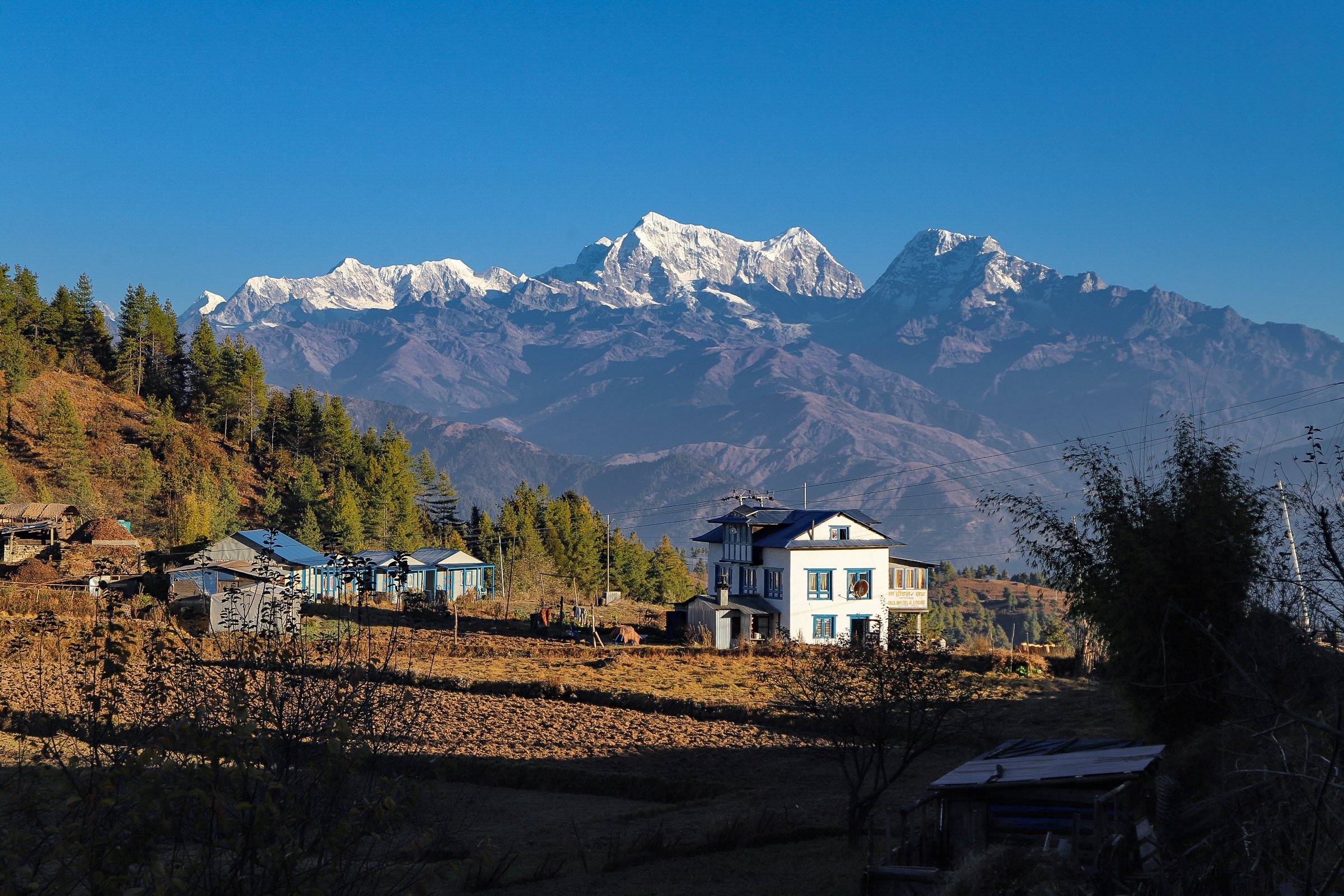
Embarking our journey from Kathmandu, we drive towards north along the Araniko highway. The drive is beautiful and pleasant passing through many villages, farming terraces, Bhote Koshi River with fabulous mountains views. Mountains like: Gaurishanker and Dorje Lakpa will be peeking at you in some places on the way. After about five hours of drive, you will reach Chautara. Chautara is the Headquarter of Sindhupalchok district where you can see a police post and a large clinic operated by Save the Children, UK. It is a small village with mixed settlement. Further, we walk for about 2 hours to reach Syaule, the destination of the day. We ascend through pleasant hill and upon arrival, make arrangement for camping overnight. From our camp site we can relax and enjoy the stunning mountain views or you can gain some insight into the culture and daily life of the village.


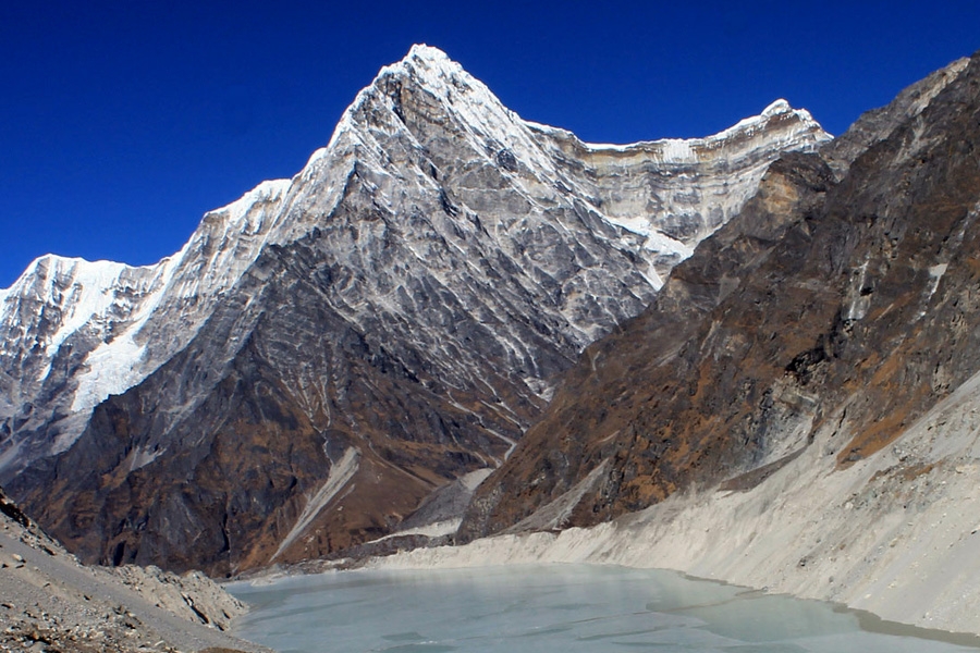
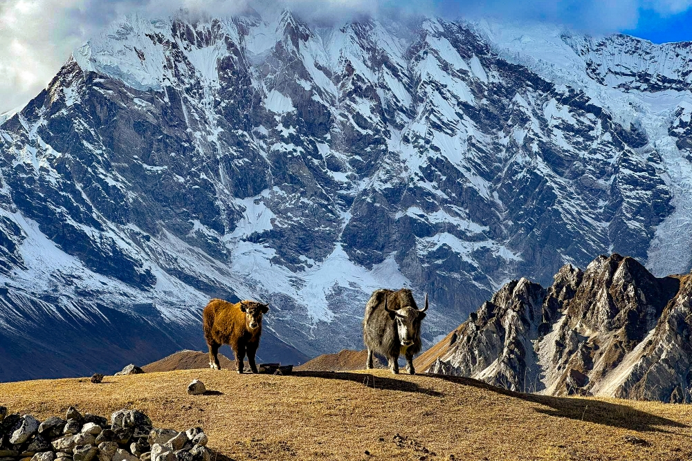
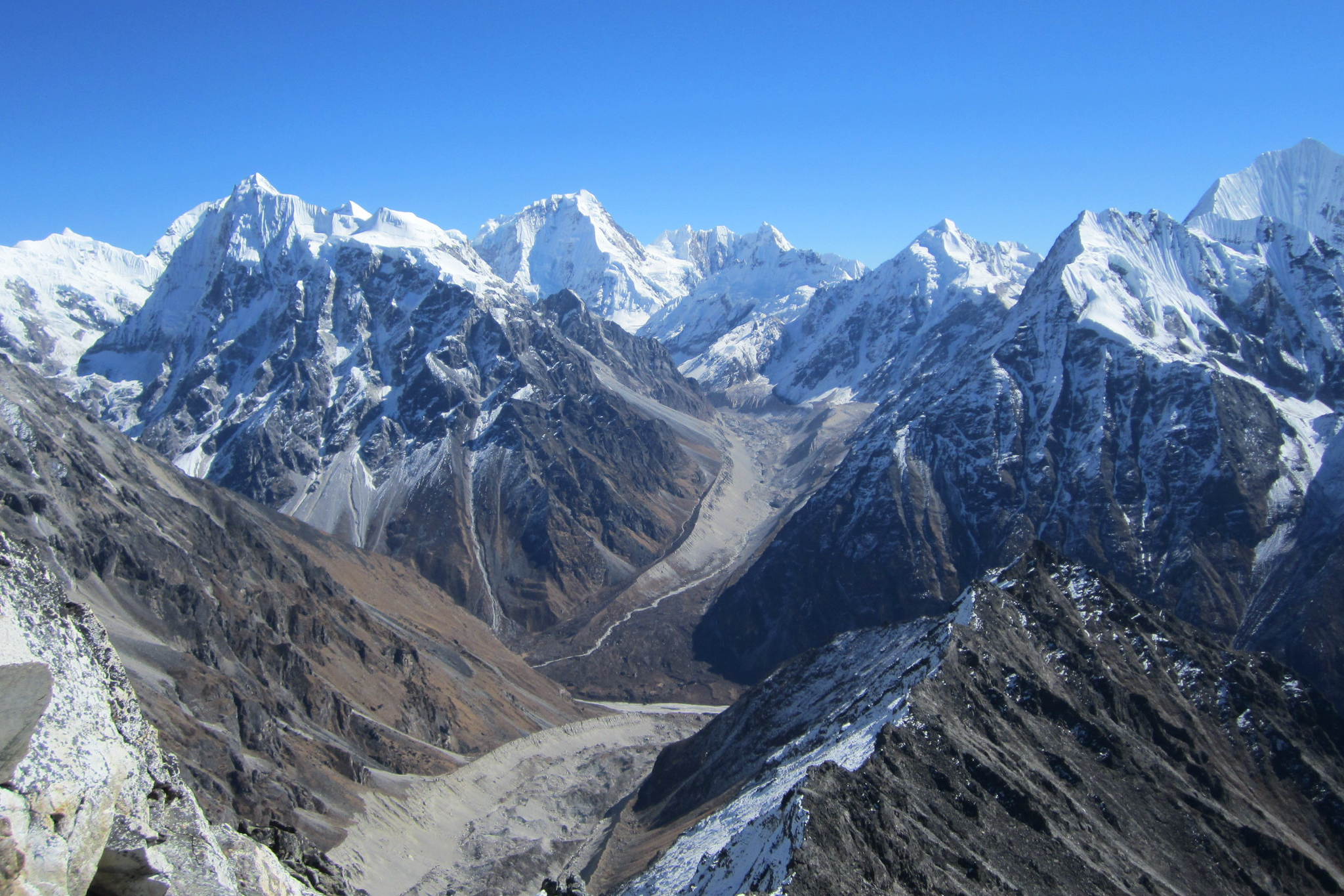
On the second day of our trek, we have a delicious breakfast on Syaule village and then head towards Okrin Danda (2300 m). The walk is a bit steep through lush green rhododendron, oak and pine forest, natural vegetation. During your walk, you might get a chance to observe some wild animals like deer, langur, monkeys and various kinds of birds including Danfe (National bird of Nepal). Continuing our walk further from Okrin Danda, we can see an unusual double Mani wall where there are fine camp sites. If you are travelling during spring then there is no water since there may be water only in the autumn, so we better fill up our water bottles before trekking further. From this point the route ascends steeply through forests full of woodcutters to the ridge crest. The next water supply is 30 minutes walk down the western slopes of the ridge. We have to walk mostly up hills till Kami Kharka. From Kami Kharka, you can have a breathtaking view of Mt. Langtang Lirung, Dorje Lakpa, Jugal Himal and some small peaks. Tonight we will camp on a summer pasture ground surrounded by forest.
Wake up early to view the beautiful sunrise from Kami Kharka Danda. From Kami Karkha Danda the route continues through an oak and rhododendron forest with magnificent views and reaches the western slopes of Chyochyo Danda. Water is scarce for much of the way. The trail follows the ridge crest, rising to a large chorten at 3160m, then traverses pasture across the western slopes of Chyochyo Danda where there are many summer pasture shelters. After another descent the trail passes a ruined stone house and a well used camp site with a good spring a short distance down the western slope. This is the first free water on the ridge and the site is an excellent one in pleasant forest. Upon arrival, explore around the hill and prepare to camp overnight.
On the following day, we have to ascend on a steep hill steadily. After walking through the grassy pastures and crossing the ridge, our walk stretches further ascends up to three hours. Then the route descends through forest, crossing gullies with water to reach another crest at Chang Samarpu (3913m.). En route, you will pass through Bamboo forest, Pine forest, Oak forest, Rhododendron forest and other alpine forest along with some beautiful mountain views. The final descent to Hile Bhanjyang is steep which lasts about one and half hour. In spring this can be in deep Snow with difficult icy section in the gullies. At Hile bhanjyang there is a campsite with water at 3800m. From Hile Bhanjyang we can see fascinating views of Waterfall, Rivers & village at a far distance. We stay overnight at camp.
Continuing our ascend steeply to a hillock at 3980 meter and then transverses open ground along a flagstone trail to another crest. You will have to pass through rocky hills and rhododendron forests. The views are wonderful in clear weather. There is a small stone house above Nasem Pati built for pilgrims and well trodden trails that lead off the ridge crest to both east and west. There is no running water here also in the spring. We have to walk up hill until we reach Nasem Pati. On the way you can see the forests with views of Jugal Himal Range, Gaurishanker Himal, Mountain deer & Danfe. Upon arrival at Nasem Pati, start preparing for camping overnight.
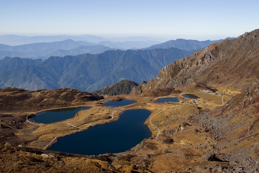
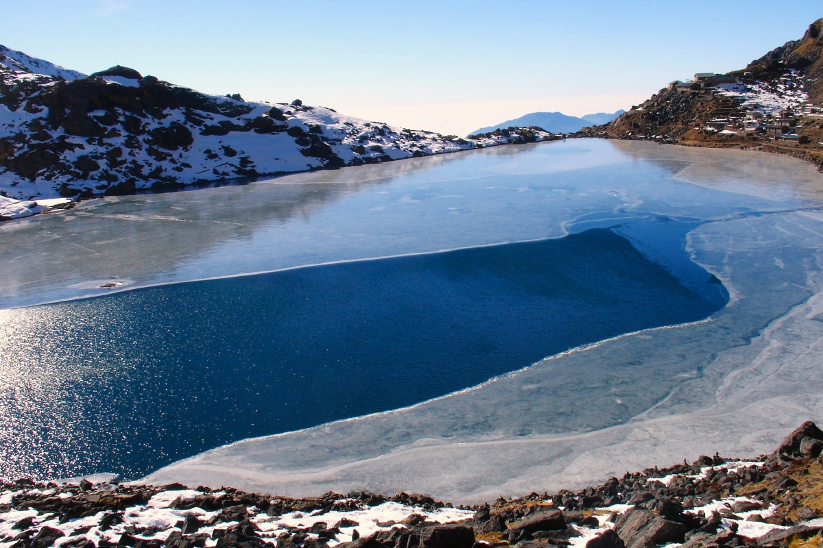
Today, you will be trekking towards Panch Pokhari, the main attraction of our whole trek. On the first part of the trail, you have to gradually ascend three hours through rocky hills. Then you will walk through a well-defined trail for about two hours before reaching Panch Pokhari. En route you will pass through alpine vegetation, Rocky Mountains, wildlife, etc. Panch Pokhari offers excellent view of Jugal Himal Range, Rolwaling range, Gosainkunda etc. Apart from lakes, this place is also famous for two pilgrim houses and a temple of Lord Shiva.
Today is an awesome day for strolling around the place. The name Panch Pokhari stands for “Five Lake” where ‘Panch means five and Pokhari means Lake’. You can see five small lakes in this place. On this day, you can walk up to the hill to see the beautiful sunrise. From the top, you can also observe Mt. Dorje Lakpa, Jugal Himal range followed by other many peaks. There are two metal-roofed huts, a sheet metal-enclosed shrine to Shiva and a pile of cast-ironed tridents. This stunning setting is a secluded pilgrimage site where the Janai Purnima festival is held in August. Many Hindu and Buddhist pilgrims visit this site each year. You should not wash in the holy stream near the temples. There is often snow on this ridge, making the trek more difficult.
Leaving Panch Pokhari, we retrace our footsteps back to Nasem Pati. The trail is pleasant enough descending towards west. You can see several ravines with water but there are no places for camping until you reach Gai Kharka. You will have to pass through forest too. Upon arrival at Gai Kharka, prepare for camping overnight.
From Gai Kharka, the trail descends through the forest crossing two major watercourses. The trail is sometimes steep and rough but is not so stressful. On the way, we pass through few substantial villages, alpine vegetation along with glorious mountain views. Then we gradually descend down a small but very steep trail directly to the bridge over the Panch Pokhari Khola. Then climbing to Hutanbrang, we again descend and follow the Larke Khola downstream to the first of the two bridges below Yangri village. This place is an ideal place for camping over night. Today, we camp at an altitude of 1360 meters on the east bank.
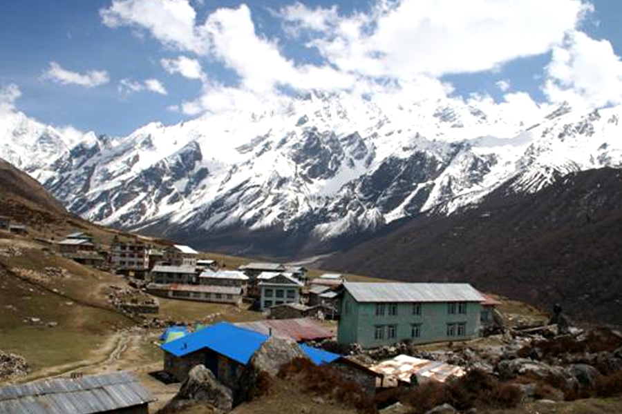
After having breakfast at Yangri village, we continue our trek towards Laghang Gompa today. We walk through several villages and pass through pleasant forest. On the way, you have to cross suspension bridges over the Larke and Yangri Khola. The climb rapidly moves to the west and north. There are lateral trails everywhere. At the South-west of Dalegaon there is a beautiful lunch or camping site with fine water and big shade trees. The trail continues, often steeply, up through country dotted with villages and fields, scrub hillside and pleasant forest. The large village between Dalegaon and Gang Kharka is called Gangdwang. From Gang Kharka a large trail leads into the next side the valley, where camping is possible, then the trail climbs relentlessly for 900 meter to Laghang Gompa. Laghang Gompa is a beautiful forested area and a lovely, quiet campsite at an elevation of 2800m. We will camp overnight at this place.
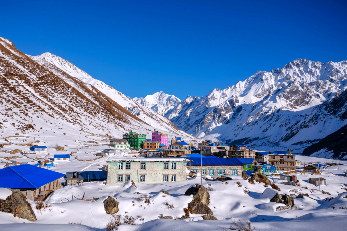
The trail is too short today in comparison to the other trekking days. We just have to walk for about three hours in order to reach Tarkeghyang from Laghang Gompa. We have to ascend through beautiful forest, and then enter an area of small pastures, stone houses, scrub growth and cow trails. Don’t get confused with the trail that leads you to Sermathang, if you are walking without guide. In that case, be sure to backtrack if you find yourself headed south on the ridge trail to Sermathang. The trail down to Tarke Gyang is very steep, rough and eroded. Upon arrival at Tarkeghyang, explore around the valley and prepare for camping overnight.
Today, we will leave Tarkeghyang and then descend down to Melamchi Gaon via Indrawati River. On the way, we pass through different villages and farming terraces. We can also see a hydro electricity project on the way to Tipani and our re-introduction to a road! Melamchi Pool Bazaar which lies at the bank of Melamchi Khola (stream) and Indrawati River is comparatively a big town for this area. It is a beautiful village with the settlement of various indigenous groups of people. You can explore around the village and get chance to communicate with the local people, observe their life style and many more. There are some lodges, tea shops, government offices, schools, colleges, post office and army police camp. We will camp overnight at this pleasant village.
From Melamchi Gaon, we descend down through terraced fields along the Indrawati River. Today’s walk is mostly on the ridge with the views of east and west downhill. We pass through stunning villages. If you are trekking during the month of March and April, then you might get chance to see the beautiful Rhododendron blossom on your way. After crossing a stream, which is dry for part of the year, the trail will make a final ascent to Tharepati, a grouping of small stone huts used in the summer months by herders.
We have to trek descending all the way and can have panoramic view of Mountains including Annapurna, Manaslu. If we are trekking in spring season, we will see the forest covered with Rhododendron.
From Kutumsang, in early morning we can see the sunrise over the snowcapped mountains. We would have breakfast served around. After breakfast, we start our trek to Chisapani (2194m). It takes about six hours to reach. Chisapani is another view point of sunrise and sunset. Besides, we would explore tribal culture and mountain lifestyle. We will camp overnight at Chisapani.
Chisopani is one of the best places from where one can enjoy the super views of Himalayas, wonderful, Hills & sunrise/sunset views can be seen. We will see the Tamang Habitants and will follow the trail across the Mulkharka and Shivapuri National Park. Then drive Sundarijal to Kathmandu which takes approximately an hour to reach Kathmandu.


Discover incredible offers for your upcoming adventure by subscribing to our newsletter with the latest travel tips and updates.