It is a panoramic thrill flying into Kathmandu on a clear day. The views of snow-capped mountain peaks sprawling down below are almost ecstatic, beginning a whole chain of memorable experiences that stay with you for a long time. A representative and driver from our office will meet you at the airport and escort you to your hotel. The representative will help you check into your designated hotel. At the hotel you will be briefed about your daily activities. Overnight at hotel.


Today after breakfast we start a guided tour to several of the most historical and spiritual attractions in Kathmandu which are also listed as UNESCO World Heritage sites. We visit the sacred Hindu temple of Pashupatinath, the famous old city “Patan” and Buddhist shrine (Boudhanath), which is also one of the largest stupas in the world. At noon, we get our equipment checked by our trekking leader, get introduced to each other, and discuss our trip. Overnight in Kathmandu.
Our journey starts at early dawn as we have a long drive ahead of us. We start right after breakfast and leave Kathmandu in the morning. We see picturesque views of Nepali countryside, lush greeneries, rivers, villages, farms and mountain vistas en route throughout the drive. Driving along the Kathmandu-Pokhara Highway to Dumre and then following the rough route by the Marshyangdi River, we pass through the low-lying villages and rice fields. After 6 hours long drive, we finally reach Beshi Sahar. Beshi Sahar is the capital of Lamjung District where we will spend our overnight.
Commencing trek from Beshi Sahar, we continue our trek turning right at the canal on the outskirts of the village and descending the narrow path to the Pam Khola. We then cross the stream and climb to the village of Denauti with its traditional red-mud houses. From here we descend to the banks of the Marshyangdi Khola and then follow the trail through rice paddies and sub-tropical forests to the Gurung village of Khudi.
Leaving Khudi, we pass a school and a forest nursery, as the trail continues northward up to the Marshyangdi Valley. After crossing a suspension bridge at Bhulbule, the trail passes a cascading waterfall and rice terraces with the magnificent views of Manaslu serving as a backdrop. Following a gentle incline we come to the village of Ngadi with its shops and teahouses. From here, the trail continues to ascend towards Bahun Danda. Bahun Danda literally means “Hill of the Brahmins” and it is the most northerly Brahmin settlement in the Marshyangdi Valley. It is situated on a long ridge and we camp in terraced fields near the village.
A steep trail descends from Bahun Danda, through rice terraces, before crossing a stream at the bottom of a small waterfall. It then climbs again and traverses the hillside high above the river before reaching the village of Hani Gaon. Ahead, the Marshyangdi valley forms a steep V-shape, and we follow the winding mountain path down through Syange and along the river for some distance. The trail then climbs steeply and the path is cut into the sheer cliff-face some 200-300m above the riverbed. Eventually we descend to the stone village of Jagat, situated on a shelf which juts into the precipitous Marshyangdi valley.
The trail from Jagat descends until it almost reaches the river and then begins to climb again through a forest. The sheer cliff on the opposite bank plunges downward but this side is also steep. When the climb ends, we follow a level track to Chamje. There is a magnificent waterfall on the opposite bank. After descending to the river and crossing a suspension bridge, we begin a climb to Sattale on a path so steep that it seems one slip would send you hurtling down into the valley. We continue on an undulating path above the river, and at one point, where a tributary flows in from the opposite bank, the main river becomes covered with huge boulders that hide the water. Climbing the zigzag path to the top of the hill, we see the level, plain of Tal before us. Though it is enclosed by cliffs, the level area looks reassuring after the harrowing mountain paths just travelled on. We descend to a grassy riverbank which leads to Tal with its hotels and teahouses. Beyond Tal, the valley narrows and the path becomes high and winding, and in several areas seems hewn from the rock itself. Beyond the small village of Karte, there is a bit more cliff-walking before the path drops again to the river. We cross a suspension bridge, and climb the short distance to the stone mani marking the entrance to Dharapani.
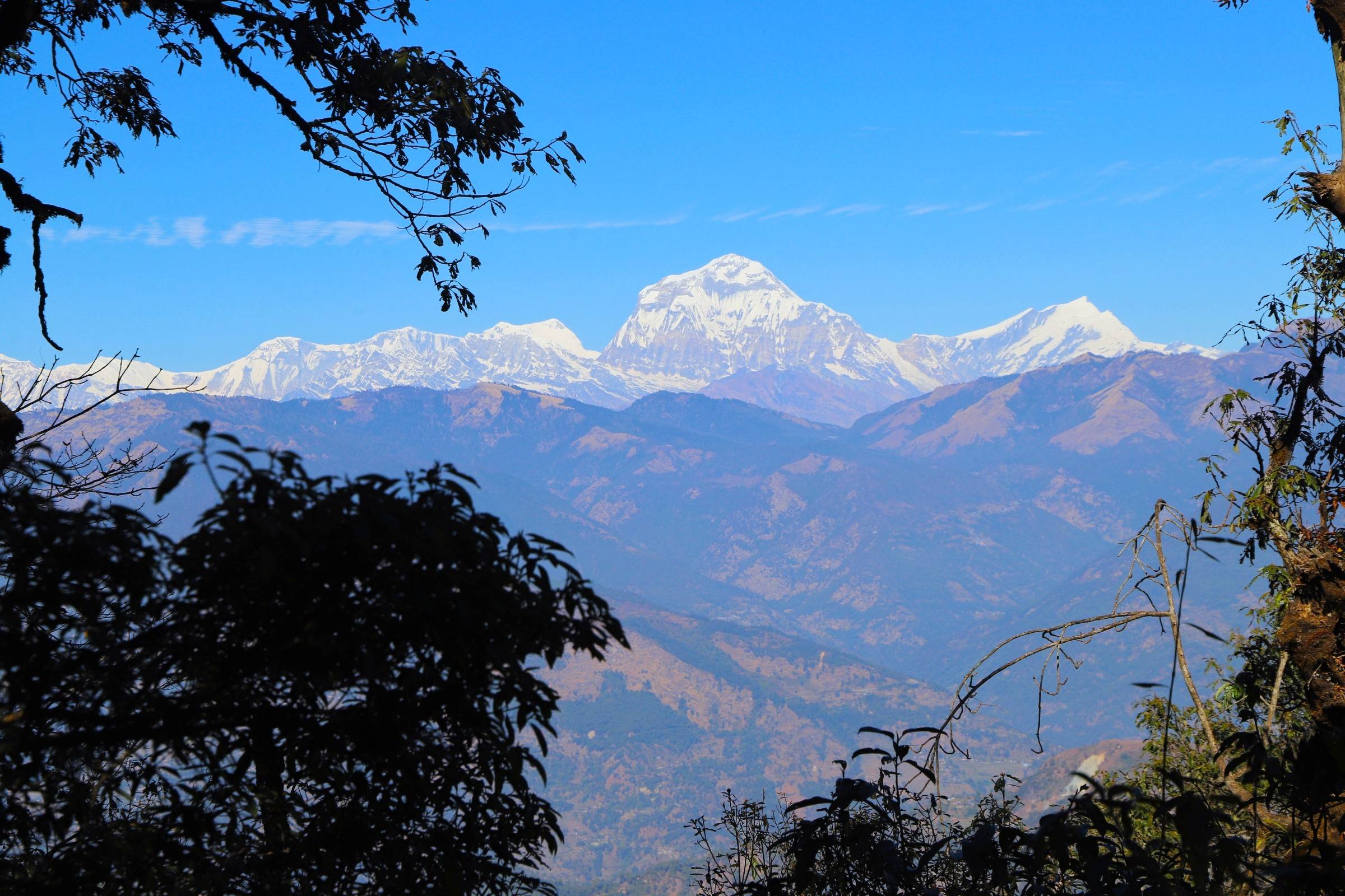
As we cut through a narrow field from the village, the Dudh Khola, which originates from the south face of Manaslu, enters on the opposite bank. The Marshyangdi then veers to the left, and as Annapurna II becomes visible ahead, we arrive at Bagarchhap, a Bhatia village with prayer flags fluttering in the breeze. Continuing to climb through forests of pine and oak, we pass through Dhanakyu before coming to a thundering waterfall. Further on, the Marshyangdi Khola enters a gorge and the path consists of steep stone steps. Pausing for breath, we can look back for views of Manaslu. When the steep incline ends we follow a path amid magnificent rhododendrons to Ratamron and then continue on a gently rising path, crossing a stream before entering a pine forest. We then cut across a loose hillside to the hamlet of Koto, 2600 m from where we can look straight up at the magnificent Annapurna II. This is also where we leave the Annapurna Circuit; we cross the Marshyangdi River and enter the Narphu valley.
Most of this first day in the Narphu valley we walk on small jungle paths, which is quite a change from the bigger trail around Annapurna. The first part is up and down and then we have a short steep ascent to Choto, 2840 m. We then have lots of steep ups and downs and the path is quite exposed above the Nar Phu Khola. At the altitude of 3090m we cross a suspension bridge; here the valley is very narrow and just before the bridge there are some hot-springs. The rock carved path now becomes very exciting, both because of danger, but also because there are some big waterfalls.
This day begins with a hard steep ascent to the abandoned Kyan village Vhaku, where there is a nice long mani wall. We continue on an amazing tunnel carved rocky path 70 meters above the river and then decent to the riverbed, we follow the riverbed and pass some Mani Chrotens. We then climb up from the riverbed to the Phu valley entrance door (Phuohi Yalgoe). About an hour from the valley entrance we cross the Phu Khola and begin climbing up to the village. Phu village consists of about 30 houses, which are home to 100-150 people. We camp near the river.
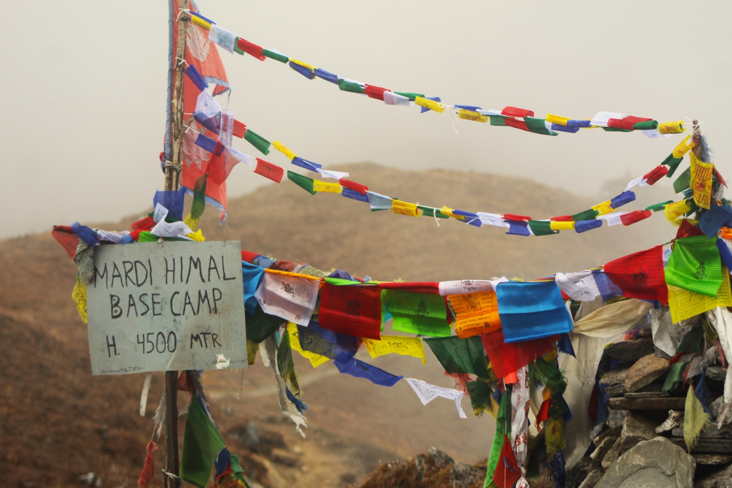
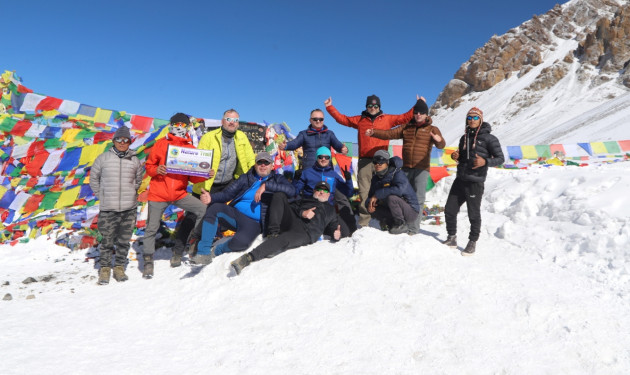
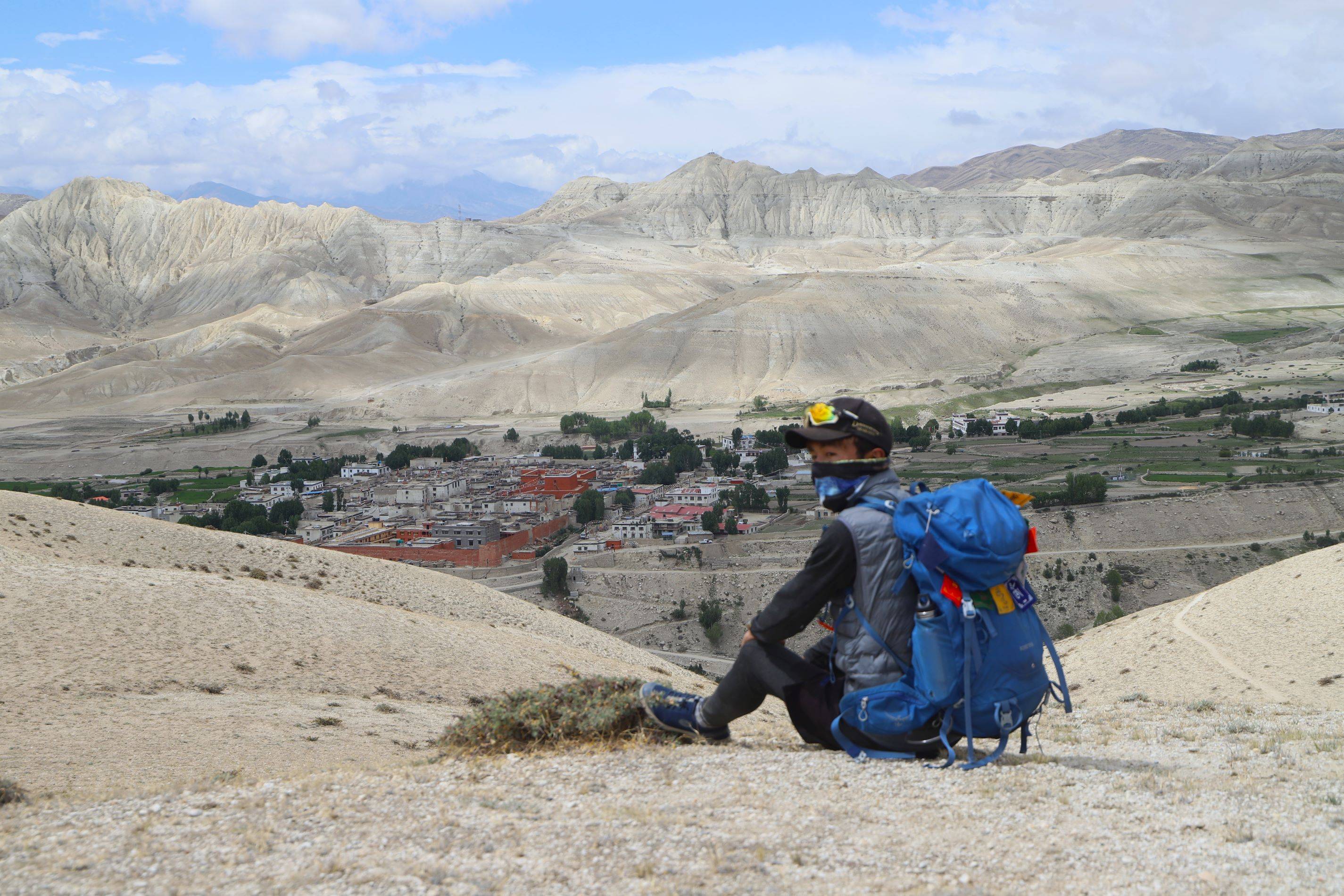
Today is the scheduled acclimatization day whereby we are suggested to rest and get acclimatized with the altitude. As we are in the Lost/Hidden Valley, we can explore the culture, natural diversity, and religious practices of the ethnic groups like Lama, Gurung and Ghale in here. Besides this, we can trace out how people make their survival depending on agriculture, animal breeding and seasonal migrations in such remote location or in the hidden valley. It is also the day for us to explore the Tashi Lakhang Monastery – the old Buddhist Monastery listed out of the 108 world’s great Buddhist Monasteries; it is supposed to be the last monastery constructed by Karmapa Rinpoche. Apart from exploring the cultural avenues of the lost valley, the valley also offers us a great view of Himlung Himal and other snow peaks in the region.
The trail descends passing many streams and suspension bridges until Mahendra Pool which takes about 4 hours. We pass the high suspension bridge 80m over the Gorge of Lapche River. We have lunch in Mahendra Pool. After lunch, the trail steeply ascends passing many Buddhist stupas until Nar Village which takes about 2 hours. We find several Buddhist Monasteries here to visit coupled with the glorious vistas of Pisang Peak and other small peaks.
From Nar, we ascend through the lateral moraine of Temdenzon Khola on a pleasant path that passes through yak pastures while providing stunning views of the west ridge of the Pisang Peak. Then, the trek will take you to Jhombu Kharka, also known as Kang la Phedi - the bottom of Kang La pass.
From Kang La Phedi, we will slowly ascend to Kang La Pass. The path is steep, but it's not too difficult. We estimate that it will take about 2 hours to cross the pass. From Kang La Pass pass, you will get beautiful views of the Annapurna II, Gangapurna, and Tilicho Peak. Then, we will trek about three more hours to reach Ngawal Village, where we will stay for the night.
Cultivated fields appear on both sides of the path and off to the right, below a craggy mountain, we can see the village of Braga with its splendid monastery. Large chortens and mani walls abound and the tall peaks of the Himalaya spread out before us – Annapurna II, Annapurna III, Annapurna IV, Gangapurna (7’455m. 24’458 ft.) and, to the rear, Tilicho Peak (7’134m. 23’405 ft) After a short steep climb we reach Manang, which is a surprisingly large village for this remote mountain region.
Thoroughly acclimatized, we advance towards Thorung La. On the way, we cross a stream, climb to Tengi 120meters above Manang and ascend further past Marshyangdi Valley turning north-west up the valley of the Jarsang Khola. Amid the spectacular vistas of Annapurna mountain range, we trek beyond the lush vegetation of scrub juniper and alpine grasses to reach the small village of Gunsang. Gunsang is a cluster of flat mud roofs just below the trail at 3’960m 12’992ft. Along the route, we see several lodges. As we approach picturesque meadows and rich forests of barberry, juniper etc, we encounter horses and yaks grazing. The trail takes us further along a large stream that flows from Chulu West and Gundang, and leads to a rich pasture at 4’000m. 13’123ft.
Leaving Letdar, we climb gradually to a ridge before descending to the headwaters of the Marshyangdi and crossing via a covered wooden bridge. After a short ascent up the mountain path on the right bank, we follow a narrow trail across an unstable screen slope and then descend to Thorang Phedi.
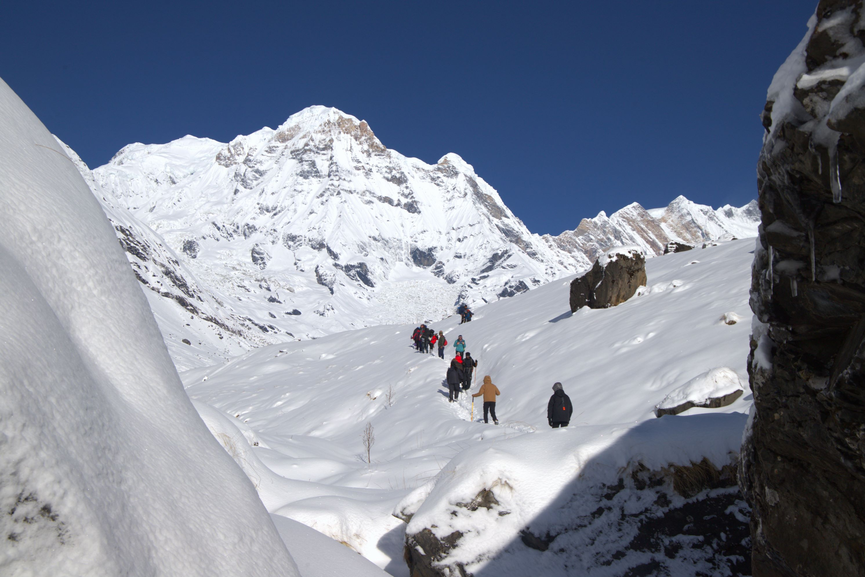
We begin the trek early today for crossing the Thorang La, 5416 m. The trail becomes steep immediately on leaving camp but as this trail has been used by local people for hundreds of years the path is well defined. The gradient then eases and after around 4 hours of steady climbing we reach the chorten and prayer flags of the pass. The views are dramatic, from the snow covered mountains above, to the head of the Kali Gandaki valley below and the brown and purple hills of Mustang which spread out before us. The descent to Muktinath is a tiring and knee pounding journey but it’s compensated for with excellent views of Dhaulagiri. Eventually the moraines give way to grassy slopes before a pleasant walk along the Jhong Khola Valley to Muktinath and its shrines and temple.
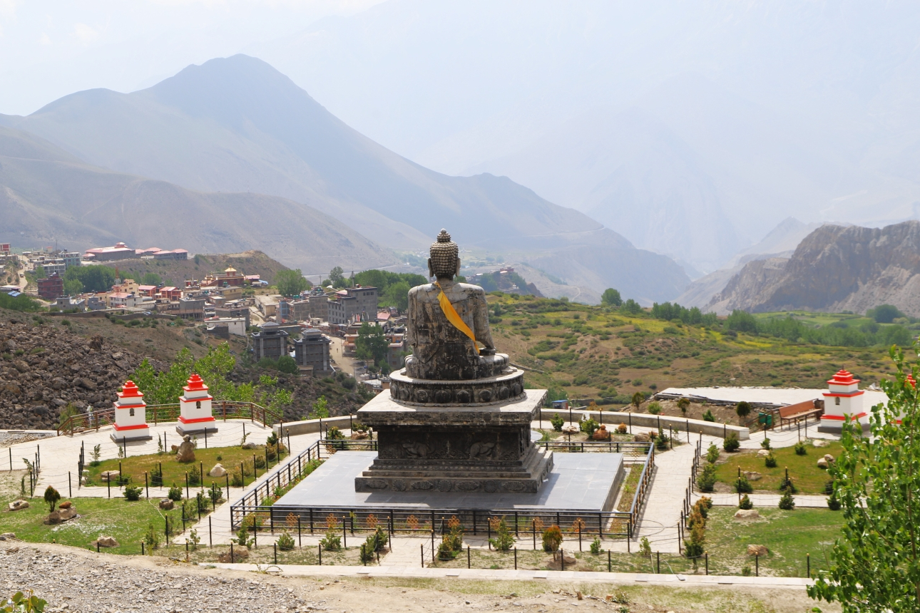
We now begin the descent down the dramatic Kali Gandaki valley, initially through arid country in the same geographical and climatic zone as Tibet. After passing through Jharkot and Khingar, villages with typical Tibetan architecture, we follow the valley floor most of the way to Jomsom and are rewarded with tremendous views of both Dhaulagiri and Nilgiri. Jomsom is a large town sprawled along both banks of the Kali Gandaki River, and it is here we will spend the final night of our trek.
We take an early morning flight to Pokhara. It is a spectacular flight along the Kali Gandaki Gorge and provides wonderful views of both the Dhaulagiri and Annapurna ranges. We then catch a further flight back to Kathmandu
Depending upon you flight time, transfer to airport for final departure. hopefully see you in a next trip. Once is not enough.

Discover incredible offers for your upcoming adventure by subscribing to our newsletter with the latest travel tips and updates.