Arrival in Kathmandu 1310 m, Welcome you to Nepal. After your arrival in the airport, our representative member will accompany and escort you to your hotel over night Hotel with Breakfast.


Today, we will spend the day sightseeing in Kathmandu Valley with our guide. We will visit Pashupatinath, which is regarded as the holiest Hindu temple in Nepal and where pilgrims worship Lord Shiva (situated on the banks of the holy Bagmati River), Bouddhanath, a Buddhist temple known as ‘Little Tibet’ and then on to Swayambhunath known as the Monkey Temple. From Swayambhunath we drive to Kathmandu’s famous Durbar Square, a UNESCO World Heritage-listed site, and located in front of the old royal palace. Upon arriving back at your hotel you may have time to do some last-minute shopping around Thamel – the tourist hub of Kathmandu.
We’ll start our journey with a drive from Kathmandu towards the western mountains which takes us to Gorkha, the Capital of Medieval Nepal. We will drive through the beautiful river view and Nepalese countryside which will takes us to Arughat. Arughat is clustered on both sides of the River Buri-Gandaki linked by a suspension bridge, this is the largest settlement in the valley and it is also a junction to various important places. The path from here across the River leads to Dhading & Trishuli Bazaar and our route from here leads north through the dirt road. Please note that the dirt road from Gorkha to Arughat may not be drivable during the monsoon season. In that case, we may have to begin our trek right from Gorkha and reach Arughat in the evening and then continue the trek next day to reach Soti Khola. The trail leads us and passes an ever-changing tableau of rice fields and Gurung villages. You will be afforded with first views of Shringi Himal from Shanti Bazaar, from where the clear glacial run-off of the Buri Gandaki provides a constant backdrop to our hike up into the mountains. Crossing a suspension bridge, we then follow the trail down to Soti Khola, where we will stay overnight. This place is also known as a landscape of the famed ‘Honey Hunters’. The foothills of Central Nepal have, for generations, been famous for their twice yearly harvests, when men gather from the surrounding villages to undertake the dangerous task of collecting the honey of the Apis Laboriosa (the world’s largest honey bee) from the cliffs that are their home.
On the first day of our trek, we will have our breakfast and then walk by the dense forest passing through a number of small villages tucked into the hillside, till we reach a widening of the valley, opposite the point where a large tributary stream enters the Buri Gandaki River. The terraced cultivated fields belong to the upper village of Lapubesi (880m). Descending down through the wide, sandy riverbed which follows a trail meandering below the steep, craggy valley side, we then climb again to mountain ridge to Almara. Further a few walk will lead you to Machha Khola for our overnight stay.
The trail today will lead us to some interesting farm villages and fields as the vegetation gradually changes. We cross the bridge and heading upstream to the tiny village of Khola Besi. There is a hot spring called “Tatopani” where many people visit to have a bath in an assumption that, by taking a bath in this river will take away all their body pains. Continuing our trek further, the trail then follows the forested area. Climbing over another ridge, we cross a huge rapid of Buri Gandaki on a suspension bridge. Then we climb on a wide, well-crafted staircase and after crossing a landslide over a ridge, we reach Doban. Further, we have to cross a suspension bridge over the Yaru Khola and then climb the stone stairs and then drop to the river and again climb more stone stairs to Thado Bharyang. To reach Jagat from here, we have to cross the west bank of the Buri Gandaki and then climb over a ridge and then trek along the river. As the elevation increases, the rapids and the scenery undergoes a complete transformation. At Jagat, there is a police check-post where your trekking permit will be checked. We will spend our overnight in Jagat.
From Jagat, we have both ascending and descending trail today. At the first part of the trail, we descend to a long series of stone steps to the river; from here the path climbs a terraced hillside to Saguleri. You can spot an eye-catching view of Sringi Himal (7,187m) from this point. After crossing the bridge over Buri-Gandaki, from Ghata-khola, the path winds up towards Philim village. From here the trails climbs slowly and gently along the hillside passing through small settlements of Aga, Lokwa. Continue from Lokwa down the exposed track until the track reaches a small place called Eklai-Bhatti near Shiar khola with great views looking over the valley towards Pangsing and Tsum Valley. Enter a very narrow gorge with loose tracks, up and down in some section. Cross to the east bank (true left) at one point and then back again to the west bank on a new suspension bridge. The trail is cut into the sheer cliff walls. Continuing our walk further, we walk to Sirdibas (1860m) with many comfortable lodges. After this dramatic portion, the track finally improves as the walk leads to Deng village for the overnight. Deng is a tiny village inhabited by Gurung who practice Buddhism.
Leaving Deng, we enter Nupri (‘the western mountains’) through bamboo forests. We walk through a newly built rock tunnel from here, thus avoiding the traditional steep climb. The houses and terrains completely changes into more Tibetan like from here onwards. The people here are of Tibetan origin along with their ancient culture. Villagers of this areas cultivates buck wheat, wheat, barley and potatoes as staple crops, beside this since trekking became popular around this area, spinach, carrots and cabbages are also grown. Our route crosses the river before scrambling steeply up onto a spectacular trail high above the river. We pass through some small settlements as we ascend the impressive valley. We will see Mani stones (prayer stones) carved into wayside rocks, a sign that we are now in a Buddhist area. Dropping down once more to the river there is a short climb to Ghap. At Ghap, the Tibetan culture begins with Mani stones and chortens all around.
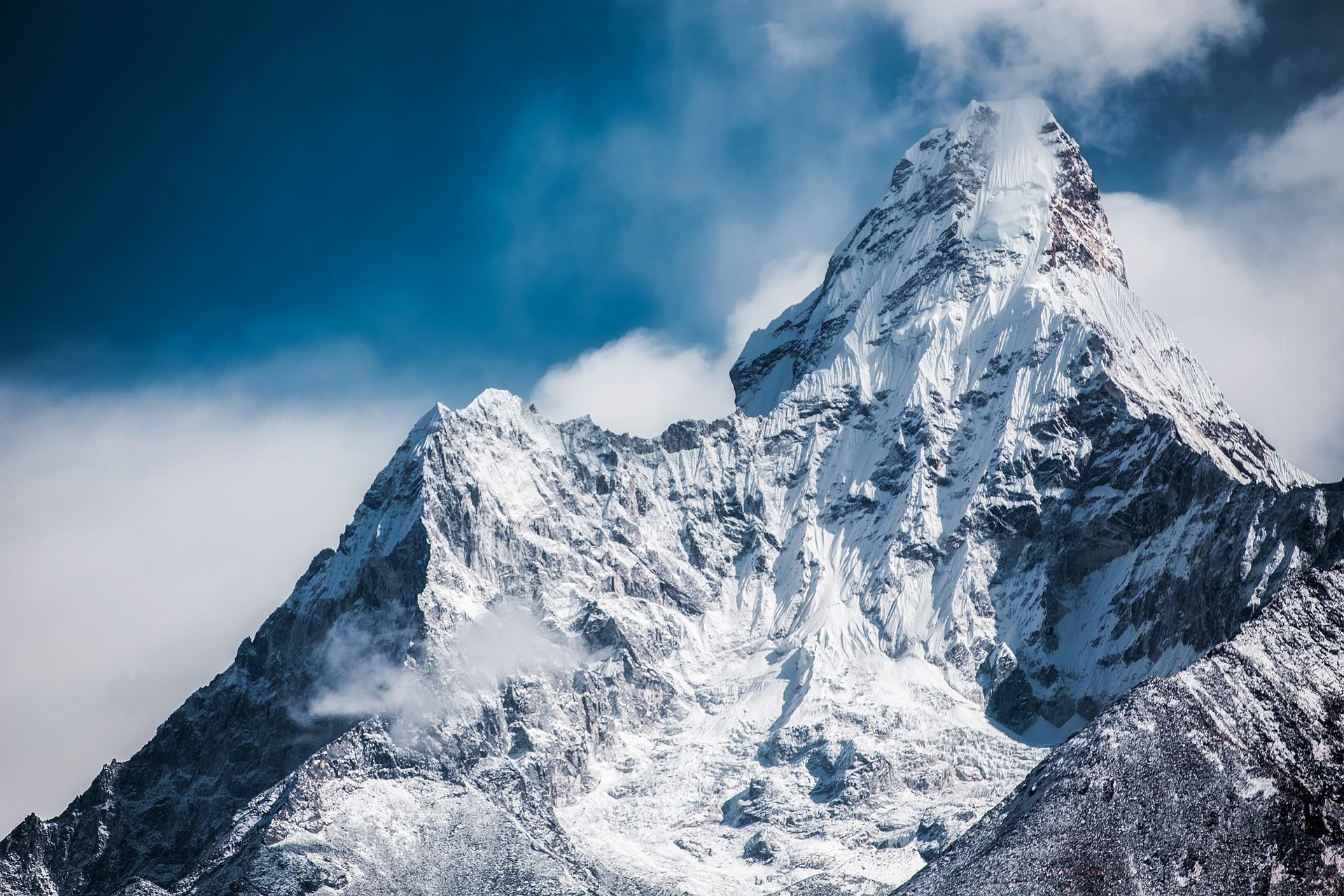
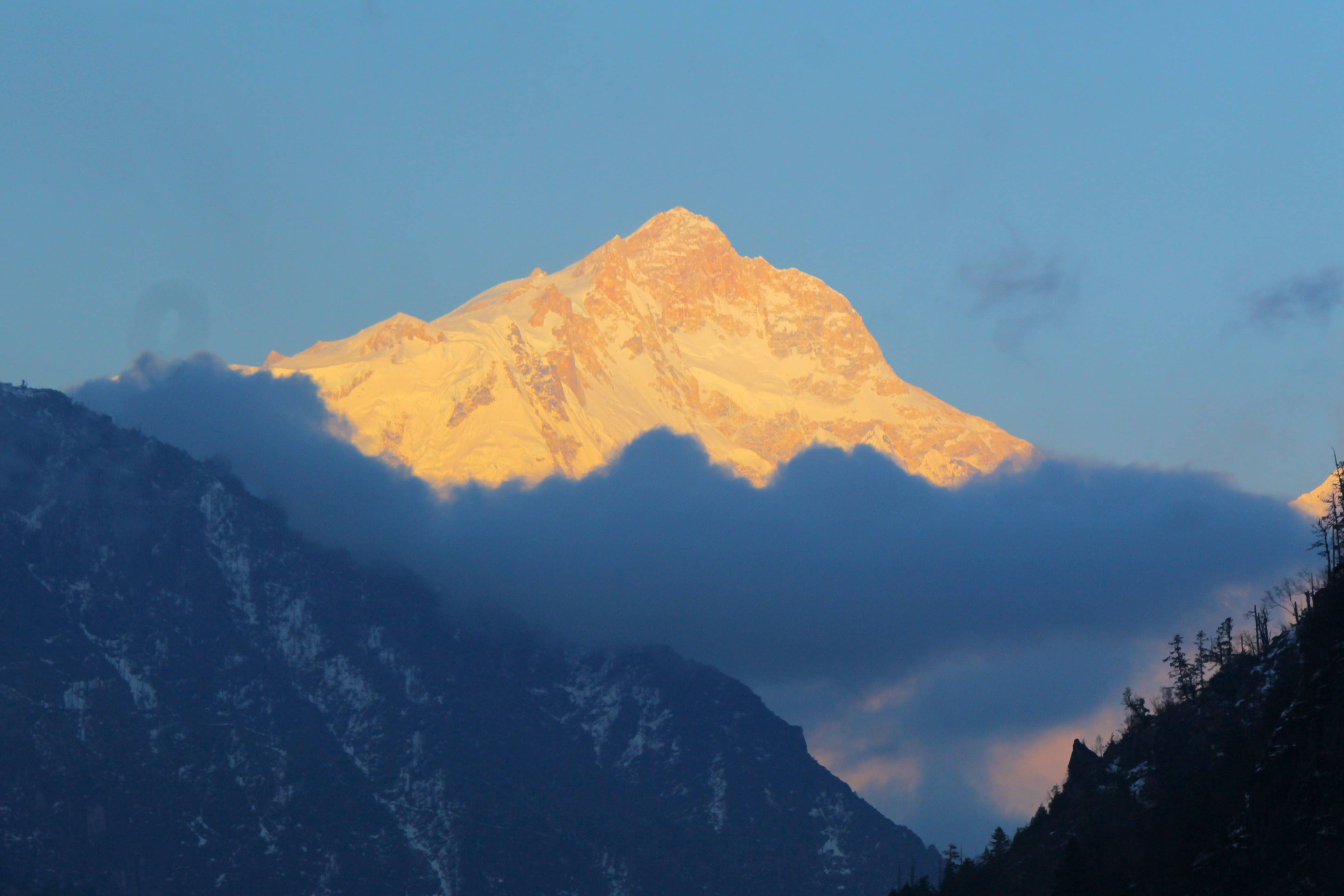
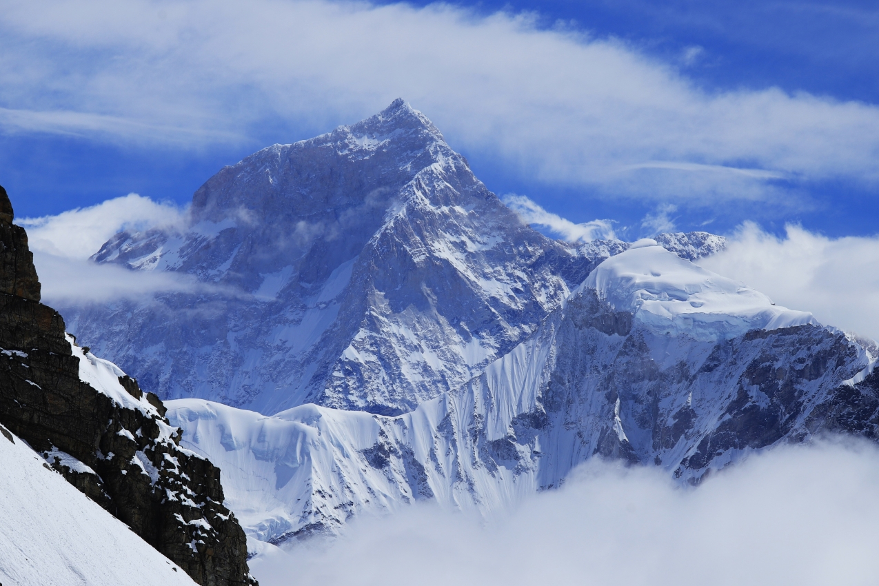
The walk today is bit longer day in comparison to other days. Continuing up the valley, the trail takes you into the mountains with time to enjoy and acclimatize. We ascend out of Lho and then follow the valley with great views of Peak 29 ahead. The views of Manaslu are stupendous. As we pass through huge mountains surround us, Himal Chuli and Peak 29 (Ngadi Chuli) to the left, Manaslu and large glaciers straight ahead, other snow summits to the right, at the far end of the valley we have just come from stands Ganesh Himal. From here, we lose the gigantic views of Manaslu and enter a world of yaks, pastures and houses which seem to have grown from the stones. From a large chorten we look down into a little dip where two rows of houses form the main part of Sama. At the far end of the village, overlooking the valley stands the well-known monastery of Sama. Only potatoes and barley can be grown at this altitude. You can stay in one of the lodges of the place.
This day is kept for you to acclimatize properly. On this day, you can just take some rest or if you want then you can make a short hike to Pungyen Gompa or to Manaslu Base Camp (4900m). You can ponder at the thousands of Mani stones with Buddhist texts and pictures. Meet the village women in Samagaon who wear a nice silver spoon as jewelry. On a little hill near Samagaon is an old Gompa. It is worthwhile to take a side trip to Pungyen Gompa, a monastery with great views of the glacier. It is named after Manaslu; Pun yen means bracelet, a good description of the two peaks. It was destroyed a year after the first unsuccessful Japanese attempt to climb Manaslu. The locals believed that the climb angered the gods, and when the Japanese came back a year they met so much resistance that they had to give up their attempt. They finally submitted the mountain in 1959. An afternoon walk to the Kargyu Chholing Gompa is also recommended.
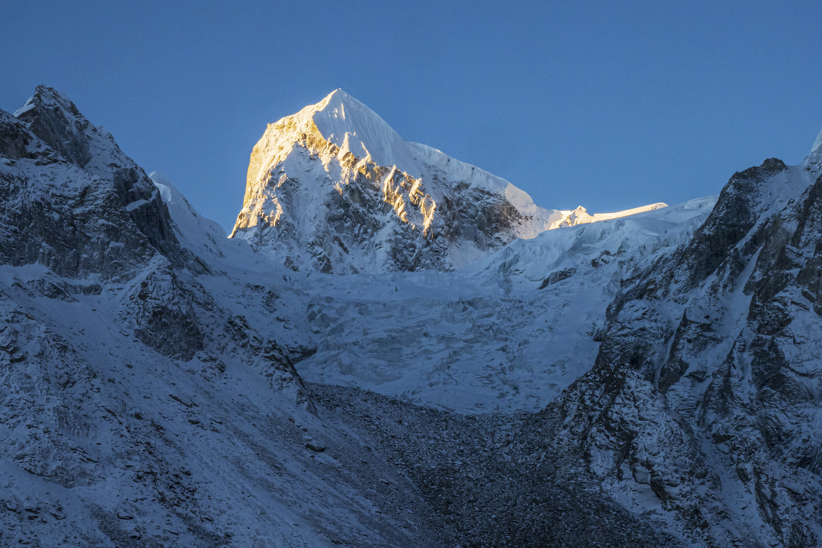
We begin our day’s trek after breakfast following a steep trail from Samagaon. The trail has a short start in the forest with gradual exposure on the steep slope above Samagaon northwards of Manaslu Glacier. With a gain in altitude the scenery becomes more spectacular with the glacier nearby and the turquoise lake beneath. The last past of the trek is the steepest portion on the trail on a slippery trail on a narrow moraine. After 4-5 hours, we will reach the base camp.
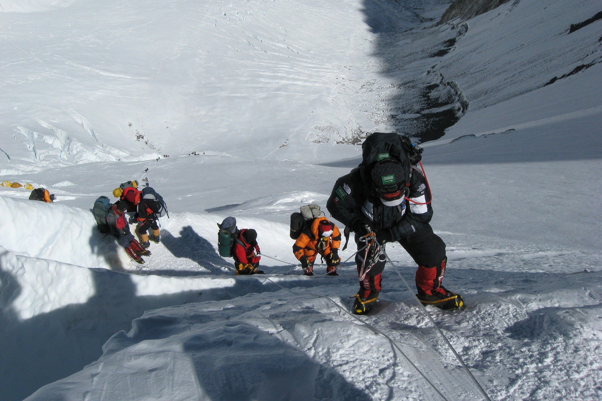
Climbing period - establish and acclimatize at various camps, following the expedition operator's itinerary and weather conditions.
Camps typically include Camp 1 (5,700 meters/18,700 feet), Camp 2 (6,400 meters/21,000 feet), and Camp 3 (7,300 meters/23,950 feet).
Climbing rotations and acclimatization hikes to progressively higher camps.
Final summit push involves climbing from Camp 3 to the summit of Manaslu (8,163 meters/26,781 feet).
After breakfast in the tent, we begin retracing on the same path that we walked to get to the base camp from Samagaon earlier. Although quite slippery, walking downhill requires lesser time and we will again be blessed by the awesome view of the glacier and the turquoise lake. We slowly begin to lose altitude as we descend and walk on the trail filled with forests before we finally reach Samagaon in around just 3 hours. Overnight in Samagaon.
Today, we descend to the Budhi Gandaki River, that has turned north and follow it to a bridge over a side stream. The trail to the left leads to the Manaslu Base camp. The Larkya la Trail passes several mani walls as the valley begins to widen. It is an easy trail on a shelf above the river passing the juniper and birch forests of Kermo Kharka. We drop off the shelf, cross the Budhi Gandaki on a wooden bridge and climb steeply onto a promontory between two forks of the river. From a stone arch we can view a large white kani. Finally passing through the kani we find Samdo. Overnight in Samdo.
Even today, we continue our walk down the edge, cross the wooden bridge over Budi Gandaki and begin walking upward. Upon crossing two streams and witnessing the Larkya Glacier we go around the valley of the Salka Khola and climb up again to the stone guest house (4450 m), which is not a lodge but a kind of shelter called Dharmshala, also known as Larke Phedi. The short walk today also leaves plenty of time for acclimatization and relaxing in the afternoon. Overnight in Dharmashala.
After a short climb, we reach a valley on the north side of the Larkya Glaciers from where we can enjoy great views of Cho Danda and Larkya Peak. Finally, we walk across moraines of the glacier, making a gradual ascent which becomes steeper only in the last section of the pass. From the pass, there are outstanding views of Himlung Himal, Cheo Himal, Kangguru and the huge Annapurna II. It is a longer day than usual to Bimtang, but to walk into these low pastures with the evening mist coming in with Mt. Manaslu looming close by is an overwhelming experience. Overnight in Bimthang.
From Bimthang, we walk south behind the moraine wall for some time before crossing the Bimthang Glacier, which can be loose underfoot. Climb up the far moraine wall quickly to avoid stone-fall and enter some of the best forest in Nepal. If you are in rhododendron season, the mauves, reds, pinks and whites are stunning amongst the huge pines and the views of the back of Mt Manaslu are superb. Cross the high pasture, descend the valley of the Burdin Khola. From a ridge at 4150 meters, you have excellent views of Manaslu to the South East and Annapurna II to the South West. Descend rapidly along the true right bank of the aptly named Dudh (‘milk’) Khola through a Bhatti at Hompuk (3420m) through rhododendron forest and follow a trail through a narrow valley until we reach the highest cultivated land in this valley at Kharche, 2785 meters. Kharche is the best point with guest house middle between the alpine forest and good views. In the next hour you will see many signs of a glacial flood, with tree trunks smashed and banks undermined, the track becoming quite rough. From here, we cross a slide, then go across fields before making a steep climb over a ridge. The trail comes off the ridge in a big, sweeping arc to the river bank at 2580m. A short distance beyond is the village of Gurung “Gho”, the first real village since Samdo. There are new lodges being built here and we will accommodate in one of them for our overnight.
The valley becomes more agricultural as you pass fields and copses of oak and rhododendron. Continue through the fields over a clear stream staying on the north (true right) bank until Tilje (2300m; Tiljet). Climb over a small ridge to the stone – paved village and wind among the closely spaced houses of this large Village. Leaving the village, cross the Dudh Khola and trek along the river embankment. Cross a wooden bridge back to the northern side of the Dudh Khola and climb up through a chorten-shaped arch and past a Mani wall to Thonje. At the village of Thonje, we go through a police checkpoint, and then continue to Dharapani. As you will have enough time after arrival at Dharapani, so you can either drive to Besisahar on the same day or stay and stroll around the place and interact with the local people. You will stay overnight at one of the lodge of Dharapani.
On the last day of our journey, we take our breakfast in dharapani then drive to kathmandu via Besisahar along the banks of the Marshyangdi and Trishuli rivers with splendid views of green hills, mountains, farming terraces and villages on both sides of road. The road head is now up-valley at Chame. Turning right takes you over the Thorang La and down the Kali Gandaki valley in about 10-14 more days. Upon arrival at Kathmandu, you will be transferred to your respective hotels. In this way, two weeks trek to the Manaslu Circuit will be completed.
Now that you have finally arrived in Kathmandu after more than a month, you finally get a rest day in the city. You can go for it any way you like. If you feel like you want to go sightseeing, that's fine too. An Outfitter Nepal representative can take you to your preferred tourist attractions.
On this day, you can shop for last-minute souvenirs for your friends back home. Thamel has a lot of souvenir shops! Before finally heading back to your home country, you can celebrate your victory with your friends and teammate in Kathmandu. You'll find impressive restaurants, bars, and pubs in Thamel. We invite you to your farewell dinner on your last day in Kathmandu. Let's celebrate the Manaslu summit together.
Your stay in Nepal is finally over. Our representative will transfer you to the International Airport, and you can now travel to your desired location or take a trip back home. We hope you enjoyed your adventure with us! We hope to see you again in Nepal. Have a safe flight!
To be successful in expedition and climbing we require better gear and also training is mandatory. Better gear and an expert team complete the journey with incredible achievements in time and at less cost. The required gears for Manaslu Expedition are as mentioned.
Group Climbing Gear;
Upper Body
Light Weight Top / Thermo Coat (2-3 Layers)
Mid Weight Top (2-3 Layers)
Heavy Weight Top (2 Layers)
Fleece Jacket (1)
Gore Text Jacket (1)
Down Jacket (1)
Wind Proof Jacket
Cotton T-Shirt For Base Camp. (2-3)
Lower Body
Light Weight Long Under Pants (2-3 Pairs)
Under Wear (5-7 Pairs)
Mid Weight Long Under Pants (2-3 Pairs)
Heavy Weight Long Under Wear
Gore Text Pant. (1)
Down Pants. (1)
Water Proof Pant. (1)
Head
Sun Cap
Desert Cap
Balaclava
Fleece Hat
Neck Gaiter (2-3)
Hands
Thin Fleece Gloves (2 Pairs)
Wind Stopper Fleece Gloves
Heavy Gloves (Mitten)
Summit Gloves
Sleeping Bags
Sleeping Bag - 20 Degree Celsius (For Base Camp)
Down Sleeping Bag - 20 To -40 Degree Celsius (Extreme Comfort)
Thermarest Mattress (Cell Foam)
Thermarest Mattress (Inflatable)
Foot Wear
Kailas / Lasportiva / Millet (Summit Shoe)
Normal Socks (5 Pairs)
Summit Socks (2 Pairs)
Trekking Shoes (1 Pair)
Camp Booties (1 Pair)
Basecamp Slipper (1 Pair)
Climbing Equipment
Climbing Helmet
Down Suit (Kailas / Marmot / Mountain
Hardware / North Face / Millet )
Crampons (Fit with Boot)
Ice Axe
Harness
Atc Guide
Jummer / Ascender
Lock Carabiner (3)
Unlock Carabiner (3)
Tape Slings (2)
Prusik Loops (1)
Snow Goggle
Head Light (4 Pairs Rechargeable Batteries Recommended)
Satellite Phone
Hand Warmer (If Possible)
Bag Packs
Rucksacks 45L - 55L
Duffle Bag 90 L -120 L (2 Pieces)
Water Proof Stuff Sacks Large (2 Pieces)
Water Proof Stuff Sacks Small (2 Pieces)
Sun Stuffs
Banana Boat/ Nivea Sun Cream -50 (Spf)
Lip Guard -20 / -50 (Spf)
Sun Glasses (UV Protection)
Glaciers Glasses (UV Protection)
Toiletries
Hand Disinfectant
Wet Tissue
Toothpaste
Toothbrush
Soap
Shampoo
Garbage Bag
Eating & Drinking
Water Bottle (2)
Thermos
Mug
Spoon/ Fork
Bowl
Medical part ;
Brufen / Ibuprofens
Antibiotic
Diamox
Paracetamol
Handy Plaster
Crack Bandage
Tincture Iodine
We also recommend bringing strong knee & ankle supports & braces, ACE bandages for sprains & strains, Tegaderm &/or other would coverings. Duct tape is always useful. We’re happy to take excess medical supplies off your hands when you leave if you won’t need them and pass them on to others. We use lots of the large amount we have with us to treat locals we meet when trekking.

Discover incredible offers for your upcoming adventure by subscribing to our newsletter with the latest travel tips and updates.