Kathmandu - Sotikhola , Dharapani - Kathmandu
Teahouses/lodges
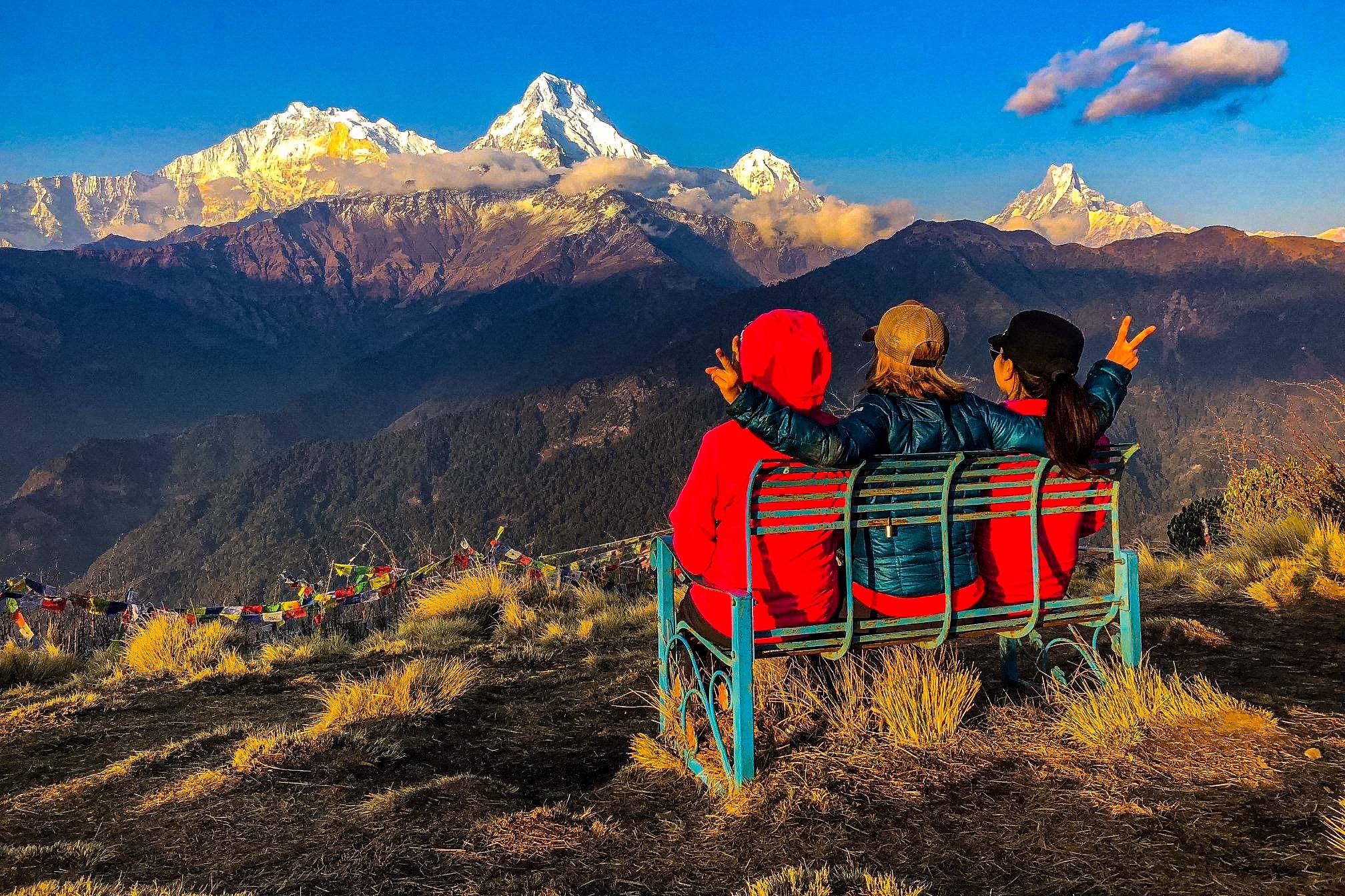
Enjoy authentic, nutritious meals at teahouses on the Manaslu trek.
The Manaslu Circuit Trek is one of the most rewarding and less-traveled trekking routes in Nepal. Nestled in the heart of the Himalayas, this adventure takes you around Mt. Manaslu (8,163m), the 8th highest mountain in the world, revered as the “Mountain of Spirit.” Considered one of the most thrilling and challenging treks in Nepal, the journey around Manaslu blends breathtaking alpine scenery, authentic cultural encounters, and diverse wildlife experiences.
Unlike the crowded trails of Everest and Annapurna, the Manaslu region remains relatively untouched, making it an ideal destination for trekkers seeking both solitude and adventure. From ancient Buddhist monasteries to high mountain passes, cascading waterfalls to remote Tibetan-influenced villages, every step of the Manaslu Circuit offers a story worth experiencing.
In this overview, we will dive deep into everything you need to know about the Manaslu Circuit Trek—its highlights, cultural significance, natural beauty, trekking routes, wildlife, villages, and practical details.
Trekking in Nepal is often associated with iconic routes like Everest Base Camp or Annapurna Circuit, but the Manaslu Circuit offers something truly unique. It combines the untouched wilderness of the Himalayas with a rich cultural heritage that few other treks can match.
Here are some reasons why adventurers choose this trek:
Remote & Less-Crowded: Unlike other commercial trekking trails, Manaslu sees far fewer trekkers, ensuring a peaceful and authentic experience.
Cultural Encounters: Explore Tibetan-influenced villages, Buddhist monasteries, and traditional Gurung settlements.
Stunning Himalayan Views: Witness panoramic views of Manaslu, Himchuli, Ganesh Himal, Annapurna ranges, and more.
Adventure at High Altitude: Crossing the dramatic Larkya La Pass (5,125m) is a highlight, offering both challenge and reward.
Rich Biodiversity: The Manaslu Conservation Area shelters snow leopards, Himalayan Thar, blue sheep, and rare red pandas.
The trek is not just about reaching a high pass—it’s about immersing yourself in the landscapes, culture, and traditions of one of Nepal’s most beautiful regions.
Mt. Manaslu, the eighth-highest peak on Earth, stands tall with a spiritual aura. Its name, derived from the Sanskrit word “Manasa” meaning soul or spirit, has earned it the title of the “Mountain of Spirit.”
For centuries, local communities have worshiped the mountain, considering it sacred. Trekking around its base provides not just scenic views but also a deep spiritual connection. Unlike Everest, which symbolizes conquest, Manaslu represents harmony between nature, people, and culture.
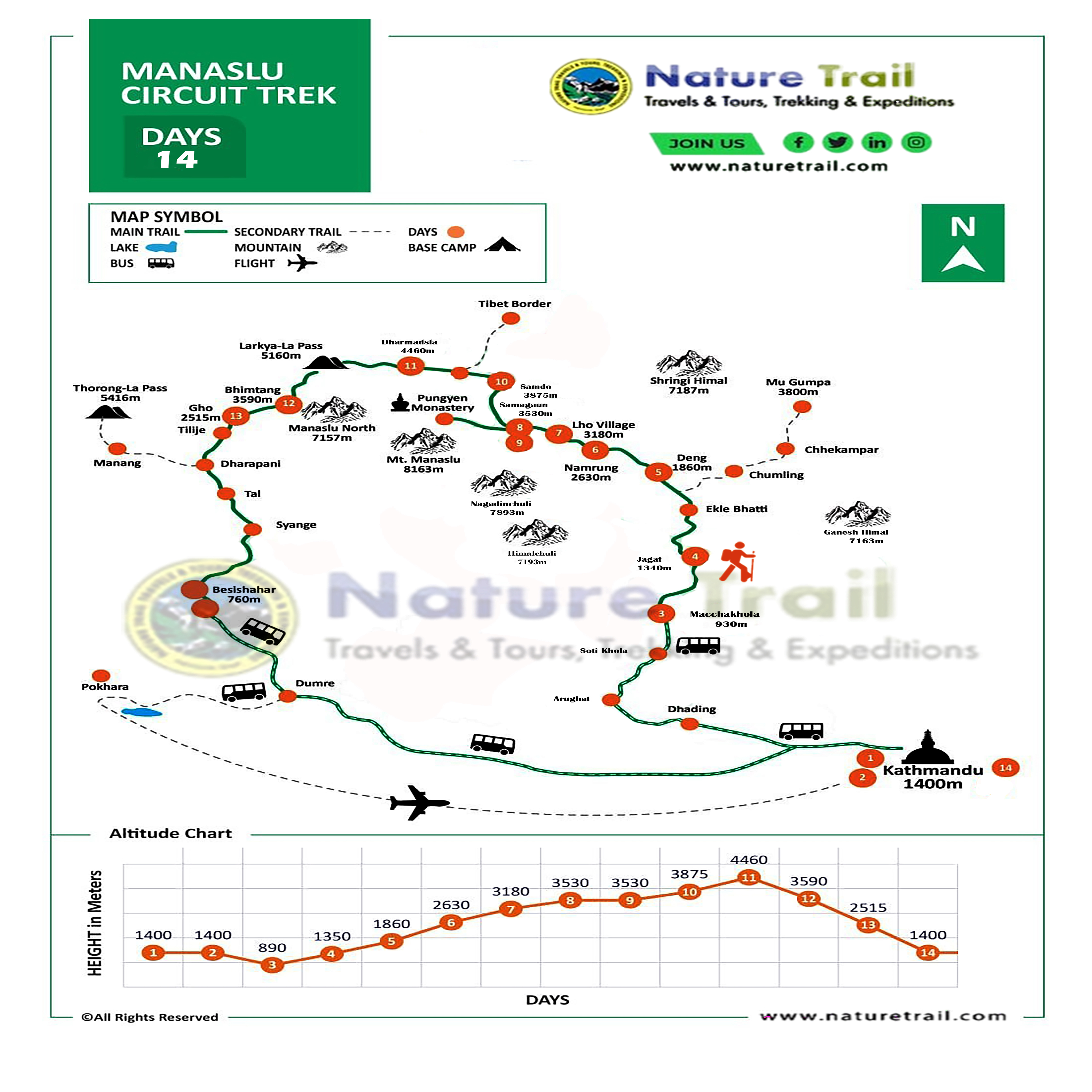
The Manaslu Circuit Trek usually takes 14 to 18 days, depending on pace and side trips. The route follows an ancient salt-trading trail that once connected Nepal and Tibet, winding along the dramatic Budi Gandaki River before climbing towards high Himalayan passes.
Arughat to Soti Khola – Starting point through lush green foothills.
Soti Khola to Machha Khola – Forested trails and suspension bridges.
Machha Khola to Jagat – Entering the Manaslu Conservation Area.
Jagat to Deng – First glimpses of Tibetan-influenced villages.
Deng to Namrung – Spectacular views of Ganesh Himal and Himalchuli.
Namrung to Lho – Manaslu appears larger and more dramatic.
Lho to Samagaon – A culturally rich village at the foot of Manaslu.
Samagaon to Samdo – Remote Tibetan-style settlement with panoramic valley views.
Samdo to Dharamsala – Base before the Larkya La pass.
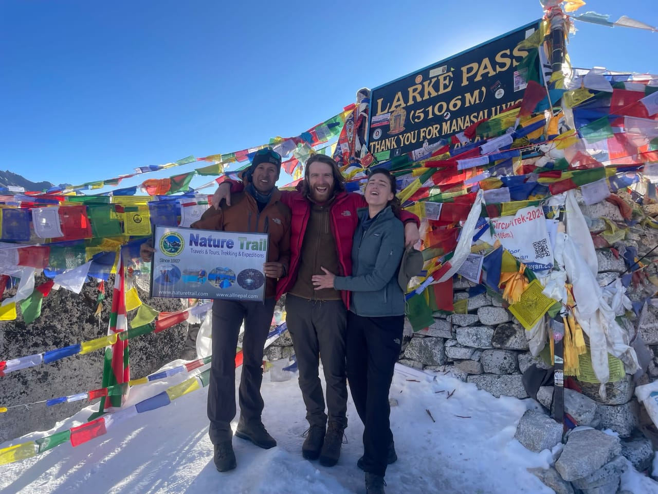
Crossing Larkya La Pass (5,125m) – The highlight of the trek, with sweeping views of Himlung Himal, Cheo Himal, and Kang Guru.
Descent to Bimthang – Meadowland with stunning views of Manaslu massif.
Bimthang to Dharapani – Connecting trail towards the Annapurna Circuit.
From Dharapani, trekkers typically follow the Marshyangdi River valley to Besi Sahar and drive back to Kathmandu.
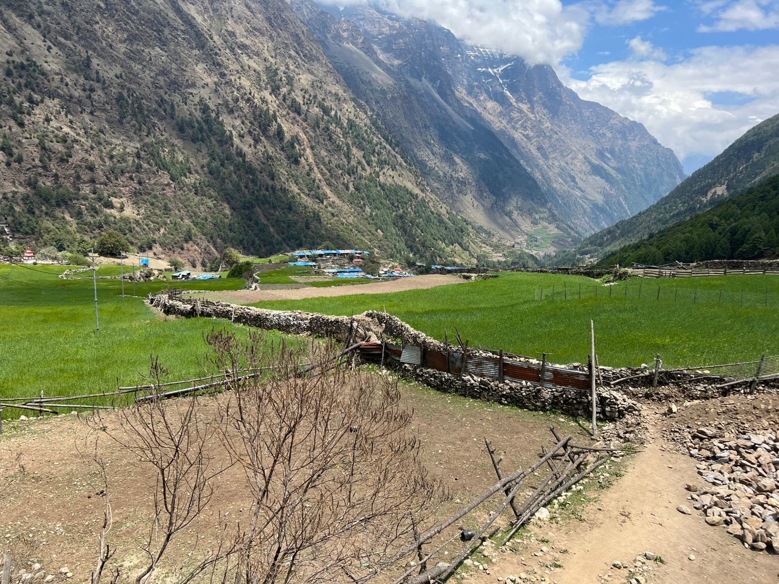
The scenic diversity of the Manaslu Circuit is extraordinary. The trek starts at just 600m in altitude and climbs to over 5,100m at Larkya La, which means you’ll experience tropical forests, alpine meadows, and high Himalayan glaciers—all in a single journey.
Forests: Oak, pine, rhododendron, and bamboo dominate the lower sections.
Rivers & Waterfalls: The Budi Gandaki River carves deep gorges, fed by countless waterfalls.
Snow Peaks: From mid-trail onwards, snow-capped giants like Manaslu, Himalchuli, and Ganesh Himal dominate the horizon.
High Passes & Glaciers: Larkya La Pass offers glacier views and a raw Himalayan experience.
Every day on the trek feels different—lush valleys one day, barren alpine landscapes the next.
One of the strongest appeals of the Manaslu Circuit is its authentic cultural immersion. Unlike commercialized trekking routes, villages here still follow traditional Tibetan Buddhist practices.
Samagaon: A picturesque village filled with monasteries, mani walls, and chortens.
Samdo: A settlement of Tibetan refugees with unique architecture and traditions.
Lho: Known for Ribung Monastery, with spectacular sunrise views of Manaslu.
Gurung Villages: Lower villages are home to the Gurung community, famous for their bravery as Gurkha soldiers in the British and Indian armies.
Trekkers also encounter Buddhist monks, nuns, and yak caravans, making the journey feel timeless and spiritual.
The Manaslu Conservation Area (MCAP) spans 1,663 square kilometers and is home to diverse flora and fauna. Trekkers may spot:
Snow Leopard (rare and elusive)
Himalayan Thar
Blue Sheep
Musk Deer
Red Panda (endangered species)
Over 110 species of birds and numerous medicinal plants also thrive here. This makes the Manaslu trek not just a cultural and scenic journey but also an ecological adventure.
The best seasons for the Manaslu Circuit are:
Spring (March to May): Rhododendrons bloom, clear skies, and mild temperatures.
Autumn (September to November): Stable weather, best mountain visibility, and comfortable trekking conditions.
Winter brings heavy snow at higher altitudes, while monsoon makes trails slippery with leeches in lower regions.
The route is dotted with tea houses and lodges offering basic but comfortable lodging. Most have simple twin-sharing rooms and communal dining areas.
Accommodation: Tea houses with wooden beds, blankets, and occasional Wi-Fi in larger villages.
Meals: Traditional Nepali dal bhat, Tibetan bread, noodles, momos, soups, and occasional Western dishes.
Trekkers can also camp, though tea houses are the preferred option.
To trek the Manaslu Circuit, you need the following permits:
Manaslu Restricted Area Permit (RAP)
Annapurna Conservation Area Permit (ACAP)
Manaslu Conservation Area Permit (MCAP)
A licensed trekking guide is mandatory for this region, ensuring safety and supporting local employment.
For trekkers with extra time, the Tsum Valley is a highly recommended side trip. Known as the “Valley of Happiness,” Tsum is a secluded Himalayan valley rich in Tibetan Buddhist culture, with ancient monasteries, meditation caves, and sacred landscapes.
Adding Tsum Valley extends the trek by about 7–8 days but provides a deeper cultural and spiritual experience.
The Manaslu Circuit Trek is challenging, requiring good physical stamina. Trekkers should prepare with:
Cardio training (running, cycling, hiking)
Strength training (legs, core, and endurance)
Altitude acclimatization awareness
Daily trekking can last 6–8 hours, often on steep trails, so mental determination is as important as physical readiness.
The Manaslu Circuit Trek is a perfect blend of adventure, culture, and nature. It remains one of the few trails in Nepal where you can still experience the raw authenticity of the Himalayas without the crowds. Whether it’s the challenge of crossing Larkya La Pass, the serenity of Samagaon Monastery, or the wildlife-rich forests of MCAP, this trek promises memories that last a lifetime.
For trekkers seeking a true Himalayan adventure that is both challenging and culturally enriching, the Manaslu Circuit stands out as a world-class trekking route.
We’ll start our journey with a drive from Kathmandu towards the western mountains which takes us to Gorkha, the Capital of Medieval Nepal. We will drive through the beautiful river view and Nepalese countryside which will takes us to Arughat. Arughat is clustered on both sides of the River Buri-Gandaki linked by a suspension bridge, this is the largest settlement in the valley and it is also a junction to various important places. The path from here across the River leads to Dhading & Trishuli Bazaar and our route from here leads north through the dirt road. Please note that the dirt road from Gorkha to Arughat may not be drivable during the monsoon season. In that case, we may have to begin our trek right from Gorkha and reach Arughat in the evening and then continue the trek next day to reach Soti Khola. The trail leads us and passes an ever-changing tableau of rice fields and Gurung villages. You will be afforded with first views of Shringi Himal from Shanti Bazaar, from where the clear glacial run-off of the Buri Gandaki provides a constant backdrop to our hike up into the mountains. Crossing a suspension bridge, we then follow the trail down to Soti Khola, where we will stay overnight. This place is also known as a landscape of the famed ‘Honey Hunters’. The foothills of Central Nepal have, for generations, been famous for their twice yearly harvests, when men gather from the surrounding villages to undertake the dangerous task of collecting the honey of the Apis Laboriosa (the world’s largest honey bee) from the cliffs that are their home.


On the first day of our trek, we will have our breakfast and then walk by the dense forest passing through a number of small villages tucked into the hillside, till we reach a widening of the valley, opposite the point where a large tributary stream enters the Buri Gandaki River. The terraced cultivated fields belong to the upper village of Lapubesi (880m). Descending down through the wide, sandy riverbed which follows a trail meandering below the steep, craggy valley side, we then climb again to mountain ridge to Almara. Further a few walk will lead you to Machha Khola for our overnight stay.
The trail today will lead us to some interesting farm villages and fields as the vegetation gradually changes. We cross the bridge and heading upstream to the tiny village of Khola Besi. There is a hot spring called “Tatopani” where many people visit to have a bath in an assumption that, by taking a bath in this river will take away all their body pains. Continuing our trek further, the trail then follows the forested area. Climbing over another ridge, we cross a huge rapid of Buri Gandaki on a suspension bridge. Then we climb on a wide, well-crafted staircase and after crossing a landslide over a ridge, we reach Doban. Further, we have to cross a suspension bridge over the Yaru Khola and then climb the stone stairs and then drop to the river and again climb more stone stairs to Thado Bharyang. To reach Jagat from here, we have to cross the west bank of the Buri Gandaki and then climb over a ridge and then trek along the river. As the elevation increases, the rapids and the scenery undergoes a complete transformation. At Jagat, there is a police check-post where your trekking permit will be checked. We will spend our overnight in Jagat.
From Jagat, we have both ascending and descending trail today. At the first part of the trail, we descend to a long series of stone steps to the river; from here the path climbs a terraced hillside to Saguleri. You can spot an eye-catching view of Sringi Himal (7,187m) from this point. After crossing the bridge over Buri-Gandaki, from Ghata-khola, the path winds up towards Philim village. From here the trails climbs slowly and gently along the hillside passing through small settlements of Aga, Lokwa. Continue from Lokwa down the exposed track until the track reaches a small place called Eklai-Bhatti near Shiar khola with great views looking over the valley towards Pangsing and Tsum Valley. Enter a very narrow gorge with loose tracks, up and down in some section. Cross to the east bank (true left) at one point and then back again to the west bank on a new suspension bridge. The trail is cut into the sheer cliff walls. Continuing our walk further, we walk to Sirdibas (1860m) with many comfortable lodges. After this dramatic portion, the track finally improves as the walk leads to Deng village for the overnight. Deng is a tiny village inhabited by Gurung who practice Buddhism,
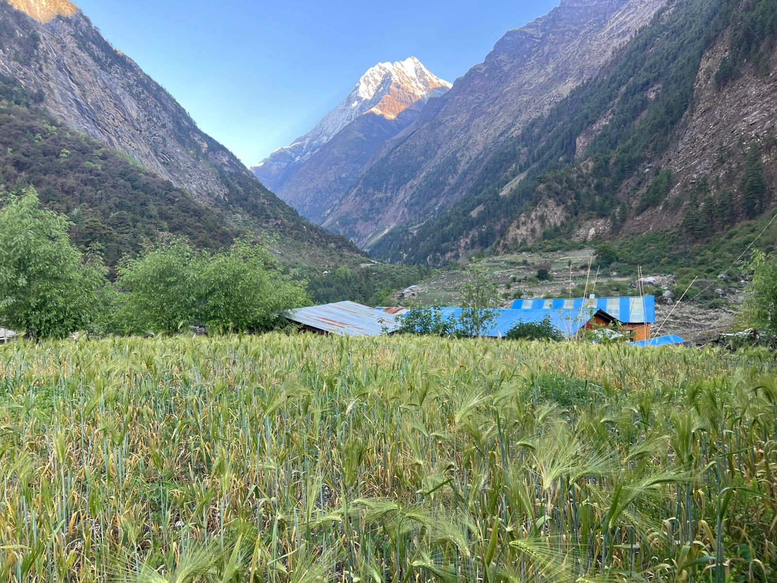
Leaving Deng, we enter Nupri (‘the western mountains’) through bamboo forests. We walk through a newly built rock tunnel from here, thus avoiding the traditional steep climb. The houses and terrains completely changes into more Tibetan like from here onwards. The people here are of Tibetan origin along with their ancient culture. Villagers of this areas cultivates buck wheat, wheat, barley and potatoes as staple crops, beside this since trekking became popular around this area, spinach, carrots and cabbages are also grown. Our route crosses the river before scrambling steeply up onto a spectacular trail high above the river. We pass through some small settlements as we ascend the impressive valley. We will see Mani stones (prayer stones) carved into wayside rocks, a sign that we are now in a Buddhist area. Dropping down once more to the river there is a short climb to Ghap. At Ghap, the Tibetan culture begins with Mani stones and chortens all around. We spend our today’s overnight in Ghap.
Today as we gain height we walk through alpine, fir and rhododendron forests, home to white-faced monkeys. Cross north on a wooden bridge with a roaring narrow canyon below then cross back to the south bank on a new swing bridge with grey langur watching. After crossing the wooden bridge over Budhi Gandaki we follow the path lined with houses that are interspersed with cultivated fields. The main trail now climbs on well-made stairs, but a highly recommended narrow shortcut to the right just after the bridge and along the riverbank is far quicker and through superb pine forest. After about an hour walk, we walk zigzag from the river to the neat village of Namrung (2660m) with shops, restaurants and the Thakali, Thakuri and Namrung lodges about the flag stoned square. We could stroll around the village, where carvings from Bihi have been painted in colours above a gateway. The architecture characteristic of upper Nupri starts here: several houses gathered together about a common courtyard and livestock shelters on the ground floor, with heavy wooden shingle roofs and log stairs to dark verandahs. From here, the valley becomes wider and there is extensive farmland all around where we may see the occasional look-out platform, built to ward off bears. Climbing steadily now, we pass the Tibetan village of Sho and just above the village we get our first view of Manaslu ahead. A little walk further on we come to our camp in Lho (3180m) where the Tibetan influence is strong. There are Mani walls, chortens, prayer flags and a large monastery. There are excellent views of Manaslu (8163m) and Manaslu North (7157m) from the mani wall at the far end of the village and from the gompa on the hill to the west. We stay overnight at Lho.
The walk today is quite short in comparison to other days. Continuing up the valley, the trail takes you into the mountains with time to enjoy and acclimatize. We ascend out of Lho and then follow the valley with great views of Peak 29 ahead. The views of Manaslu are stupendous. As we pass through huge mountains surround us, Himal Chuli and Peak 29 (Ngadi Chuli) to the left, Manaslu and large glaciers straight ahead, other snow summits to the right, at the far end of the valley we have just come from stands Ganesh Himal. From here, we lose the gigantic views of Manaslu and enter a world of yaks, pastures and houses which seem to have grown from the stones. From a large chorten we look down into a little dip where two rows of houses form the main part of Sama. At the far end of the village, overlooking the valley stands the well-known monastery of Sama. Only potatoes and barley can be grown at this altitude. You can stay in one of the lodges of the place.
This day is kept for you to acclimatize properly. On this day, you can just take some rest or if you want then you can make a short hike to Pungyen Gompa or to Manaslu Base Camp (4900m). You can ponder at the thousands of Mani stones with Buddhist texts and pictures. Meet the village women in Samagaon who wear a nice silver spoon as jewelry. On a little hill near Samagaon is an old Gompa. It is worthwhile to take a side trip to Pungyen Gompa, a monastery with great views of the glacier. It is named after Manaslu; Pun yen means bracelet, a good description of the two peaks. It was destroyed a year after the first unsuccessful Japanese attempt to climb Manaslu. The locals believed that the climb angered the gods, and when the Japanese came back a year they met so much resistance that they had to give up their attempt. They finally submitted the mountain in 1959. An afternoon walk to the Kargyu Chholing Gompa is also recommended.
This is another short day trek because of the altitude. The trail crosses grassy grazing areas and climbs gradually up the valley. We walk through a yak pastures up a broad valley with long Mani walls, which is a pleasant walk. We have fantastic views of the mountains with Manaslu looking particularly impressive. Finally leave the tree line behind, although low-lying juniper is all around, climbing to a ridge and drop to cross the Buri Gandaki on a wooden bridge. We finally reach Samdo, sometimes after reaching White Kani. Samdo is a picturesque village dedicated to yak herding. This remote village is only a day’s walk from the Tibetan border which currently is blocked by China even for locals. Settlement of animal and fodder are much more than the human settlement here. There will be time in the afternoon to look round the village and explore the surrounding hills. There is a lot of Chinese and Tibetan alcohol and food for sale in Samdo. We stay overnight at one of the lodges there.
We continue our walk down the edge, descending beyond Samdo on a broad trail. Cross the wooden bridge over the much-reduced Buri Gandaki at 3850m and start walking upward. Pass the trail to Tibet to the right and climb left after a mani wall, traversing through juniper with many marmots in April but not November when they hibernate. Cross two streams on narrow track and witness the Larkya Glacier. These ravines are too icy during winter. There is no Larke Bazaar despite what many maps assert; at one time traders from Namche Bazaar came through Tibet to trade in this area and maybe some of the scattered stone shelters you will pass were part of that market. Go around the valley of the Salka Khola and climb up again and come to the stone guest house (4450 m) which is not a lodge but a kind of shelter called Dharmashala, also known as Larkya Phedi / Larkya Rest house. Dharmashala is now a seasonal village with dark stone rooms and tents for at least 50 people, and a dirt-floored but efficient dining hut. Even toilets are available. In 2012 this entire place opened 1 October and closed for winter on 24 November, so check in Samdo before counting on staying here. The area is filthy with toilet trenches, rubbish and blowing toilet paper so be careful where you get your water. The views are marvelous. A large herd of blue sheep call the tussock-covered hills home and you may see snow leopard prints in fresh snow around the toilets.
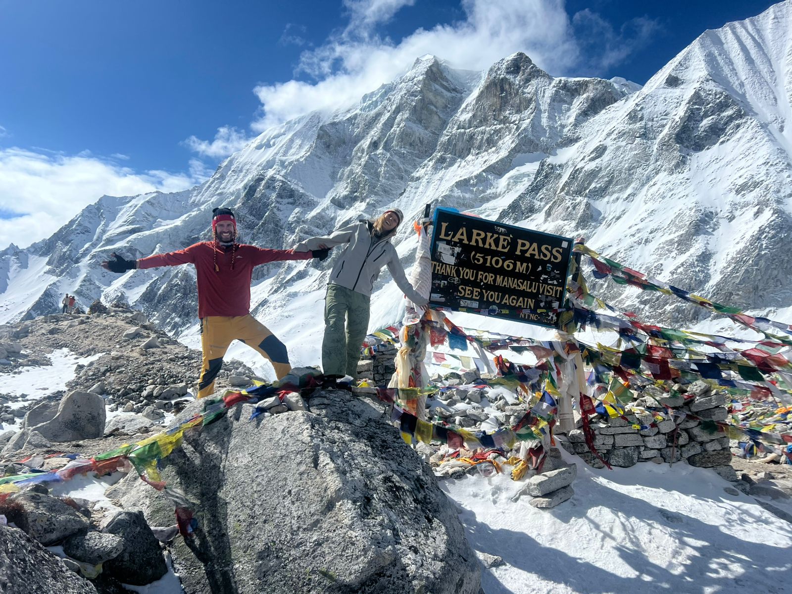 On this day, we trek to Bimthang via Larkya Pass. Note that if snow has fallen overnight and there have been high winds, then there may be less snow as you climb making the pass still crossable. Climb steadily over the ridge behind Dharmashala and beside the large lateral moraine of the Larke Glacier. There are several places where snow or ice would make this treacherous and some groups fix a rope on the steepest piece. The climb is not difficult but it is long and rocky underfoot, particularly as you top the moraine. Look for cairns and metal snow poles which assist route finding. Descend past four frozen lakes and make a final tiring climb to the left up to Larkya La (5160m), marked by prayer flags. Finally, we walk across the moraines of the glacier, making a gradual ascent which becomes steeper only in the last section to the pass. It takes about 3-5hrs to reach the pass and it can be very cold and windy with a risk of exposure if under-equipped or ill. The peaks to the west are Himlung (7126m) near Tibet, Cheo Himal and Kang Guru (6981m) and Annapurna II (7937m) in the Annapurna Range. Savor the spectacular views from the top of the pass. It is a longer day then usual to Bimthang, but to walk into these low pastures with the evening mist coming in and Manaslu; it’s an experience not to be missed. The track now runs left of the large lateral moraine, rocky at times, in a widening and beautiful valley all the long way to very scenic Bimthang ‘plain of sand’, a descent of 1400m in about 3hrs. The views during the descent are huge – icefalls and mountains in all directions, a medial glacial lake (Pongkar Tal) between the Pongkar and Salpudanda Glaciers, and the joining of these two glaciers with a third glacier to form the Bimthang Glacier whose lateral moraine towers over Bimthang. The lodges found here are of new chalet-style.
From Bimthang, we walk south behind the moraine wall for some time before crossing the Bimthang Glacier, which can be loose underfoot. Climb up the far moraine wall quickly to avoid stone-fall and enter some of the best forest in Nepal. If you are in rhododendron season, the mauves, reds, pinks and whites are stunning amongst the huge pines and the views of the back of Mt Manaslu are superb. Cross the high pasture, descend the valley of the Burdin Khola. From a ridge at 4150 meters, you have excellent views of Manaslu to the South East and Annapurna II to the South West. Descend rapidly along the true right bank of the aptly named Dudh (‘milk’) Khola through a Bhatti at Hompuk (3420m) through rhododendron forest and follow a trail through a narrow valley until we reach the highest cultivated land in this valley at Kharche, 2785 meters. Kharche is the best point with guest house middle between the alpine forest and good views. In the next hour you will see many signs of a glacial flood, with tree trunks smashed and banks undermined, the track becoming quite rough. From here, we cross a slide, then go across fields before making a steep climb over a ridge. The trail comes off the ridge in a big, sweeping arc to the river bank at 2580m. A short distance beyond is the village of Gurung “Gho”, the first real village since Samdo. There are new lodges being built here and we will accommodate in one of them for our overnight.
The valley becomes more agricultural as you pass fields and copses of oak and rhododendron. Continue through the fields over a clear stream staying on the north (true right) bank until Tilje (2300m; Tiljet). Climb over a small ridge to the stone – paved village and wind among the closely spaced houses of this large Village. Leaving the village, cross the Dudh Khola and trek along the river embankment. Cross a wooden bridge back to the northern side of the Dudh Khola and climb up through a chorten-shaped arch and past a Mani wall to Thonje. At the village of Thonje, we go through a police checkpoint, and then continue to Dharapani. As you will have enough time after arrival at Dharapani, so you can either drive to Besisahar on the same day or stay and stroll around the place and interact with the local people. You will stay overnight at one of the lodge of Dharapani.
On the last day of our journey, we take our breakfast in dharapani then drive to kathmandu via Besisahar along the banks of the Marshyangdi and Trishuli rivers with splendid views of green hills, mountains, farming terraces and villages on both sides of road. The road head is now up-valley at Chame. Turning right takes you over the Thorang La and down the Kali Gandaki valley in about 10-14 more days. Upon arrival at Kathmandu, you will be transferred to your respective hotels. In this way, two weeks trek to the Manaslu Circuit will be completed.
| Category | Items |
| Documents | Passport, Permits, Insurance, Photos |
| Main Bags | Duffle (90-100 L), Daypack (30-35 L) |
| Jackets | Woolen jackets, down jackets, windproof |
| Headwear | Sun hat, beanie, buff, sunglasses |
| Upper Body | Base, trekking, insulation, shell tops |
| Lower Body | Trek pants, shorts, underwear, shells |
| Hands/Feet | Gloves, boots, woolen socks, camp shoes |
| Sleeping | Sleeping bag, earplugs |
| Trekking Gear | Poles, water bottles, purifier |
| Accessories | Rain covers, packing cubes, locks |
| Hygiene | Towel, kit, wet wipes, sanitizer |
| Electronics | Power bank, charger, camera, and torchlight with spare batteries |
| Med/First Aid | Kit, medicine, Diamox, blister kit |
| Food/Snacks | Energy bars, trail mix, drinks |
| Dry Bags/Packing cubes | To keep contents organized and dry |
| Bootlaces | extra bootlaces |
| Extras | Microspikes, repair kit, games, journal |
Yes, it’s slightly more challenging due to remoteness and altitude gain — but it's also more rewarding.
The Manaslu Circuit Trek difficulty is considered moderate to challenging. Trekkers cross the Larkya La Pass (5,160m). This trek needs good fitness. However, with proper acclimatization, most trekkers finish it successfully.
The Manaslu Circuit Trek cost usually ranges from $900 to $1,600 per person. This cost depends on the trekking package, number of days, and included services like a guide, porter, meals, and permits.
Yes, the trek is in a restricted area of Nepal. You must hire a licensed guide and trek with at least two people or join a group. Independent trekking is not allowed.
The best time for the Manaslu Circuit Trek is during autumn (Sept–Nov) and spring (Mar–May). These seasons offer stable weather, clear mountain views, and comfortable trekking conditions.
The standard Manaslu Circuit Trek itinerary lasts 12 to 18 days. This depends on acclimatization days and side trips, like Tsum Valley.
Absolutely! The trek has beautiful views of the Himalayas. It also features rich Tibetan culture and exciting challenges. Plus, there are fewer crowds. This makes it one of the best trekking experiences in Nepal.
The highest point of the Manaslu Circuit Trek is the Larkya La Pass, located at 5,160 meters (16,930 feet). Proper acclimatization is necessary to avoid altitude sickness.
Yes, beginners with good physical fitness can complete the trek. However, the Manaslu Circuit is moderately difficult. First-time trekkers should train ahead of time and trek with a licensed guide.
Yes ,The trek is safe with a professional guide. Trails are well-established, and teahouses provide food and accommodation. Always carry proper gear and travel insurance that covers high-altitude trekking.
Trekkers stay in teahouses and lodges that provide basic rooms, meals, and hot drinks. Accommodation is simple but comfortable enough for trekkers.
Yes. Travel insurance that covers emergency evacuation above 5,000 meters is highly recommended for the Manaslu region.
Yes, Many trekkers add a Tsum Valley side trip to their Manaslu Circuit Trek itinerary. This side trip has hidden Buddhist monasteries and cultural villages.
A standard Manaslu trekking package includes:
Guide and porter services
Trekking permits
Manaslu Restricted Area Permit (RAP)
Manaslu Conservation Area Permit (MCAP)
Annapurna Conservation Area Permit (ACAP)
Accommodation and meals during the trek
Transport (bus/jeep from Kathmandu to Soti Khola)
Itinerary planning and support
The Manaslu Circuit Trek distance is about 177 km (110 miles). It usually takes 12 to 18 days to complete, depending on your pace and side trips.
Yes. The Manaslu Circuit Trek cost is usually lower than the Everest Base Camp trek. This is because food and lodging are a bit cheaper. There are also fewer flight costs since you can use overland transport instead of flying to Lukla.
It is not required, but having previous trekking experience in Nepal or other high-altitude areas is helpful. This can make your trek more enjoyable.

Discover incredible offers for your upcoming adventure by subscribing to our newsletter with the latest travel tips and updates.